
Virtual Site Tours using Drones
Overview
Virtual Site Tours using Drones create immersive 360° interactive experiences that allow remote clients, investors, and stakeholders to explore project sites from anywhere in the world. By combining panoramic drone imagery with 3D models, this application increases transparency, engagement, and decision-making confidence.
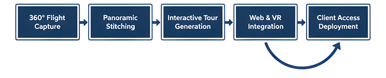
Process Flow
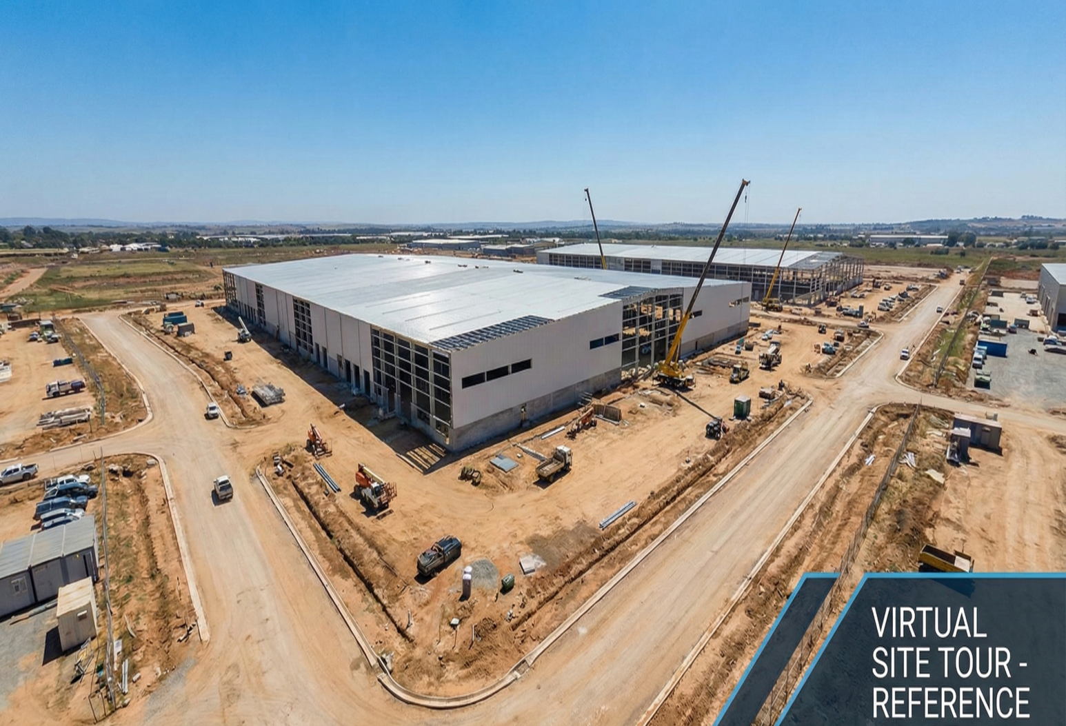
Reference Image
Relevant Outcomes / Deliverables
| Deliverable | Format | Usage |
|---|---|---|
| 360° Virtual Tours | Web / MP4 | Remote site walkthroughs and client presentations |
| 3D Interactive Models | WebGL | Investor presentations and project visualization |
| Panoramic Images | JPG | Marketing collateral and digital engagement |
| Virtual Experience Package | Web Link / ZIP | Remote stakeholder reviews and approval workflows |
Achievable Accuracy
| Parameter | Typical Accuracy | Depends On |
|---|---|---|
| Visual Resolution | 4K–8K | Camera quality and capture settings |
| Model Accuracy | ±3–5 cm | Photogrammetry quality and overlap |
| Panoramic Stitching Quality | High-fidelity immersive output | Image alignment, lighting, and processing workflow |
Key Advantages
- Enables remote project viewing from any location
- Improves transparency for clients and investors
- Enhances stakeholder engagement and visual understanding
- Reduces travel time and associated costs
- Speeds up approvals and remote decision-making
Compatible Drone Platforms
- 360° Capture Drones
- Enterprise Cinematic UAVs
Supported Sensors / Payloads
- 360° Panoramic Cameras
- High-Resolution RGB Cameras
Industry Segments Benefited
- Real Estate
- Infrastructure
- Smart Cities
- Tourism
- Commercial Developments