Environmental Impact Studies using Drones
Overview
In 2025, Environmental Impact Studies using Drones have transitioned from experimental tools to the industry standard for high-precision ecological monitoring. These unmanned platforms provide a non-invasive method to collect granular data on air quality, vegetation health, and wildlife populations without disturbing local habitats. Equipped with multispectral and LiDAR sensors, drones generate Digital Twins of ecosystems that offer up to 100x more detail than traditional satellite imagery. They enable researchers to access hazardous or remote environments such as wetlands and contaminated zones, ensuring human safety while identifying invisible threats like methane leaks or invasive species. This technology transforms environmental assessments into a dynamic, real-time process, enabling predictive modelling for flood risks, soil erosion, and sustainability planning. Ultimately, drones empower stakeholders to balance industrial development with strong conservation and regulatory compliance goals.
Process Flow
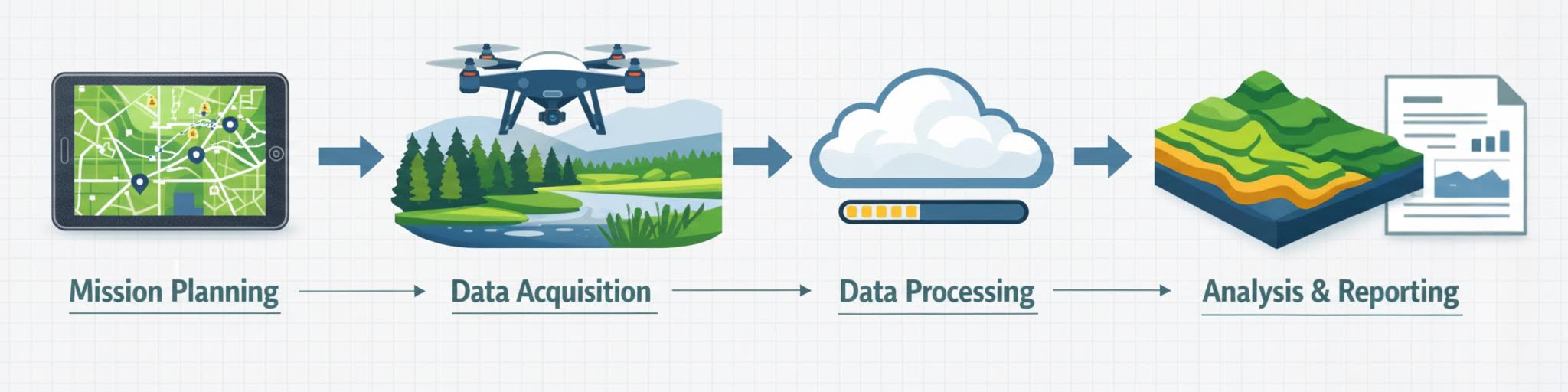
Reference Image
Relevant Outcomes / Deliverables
| Deliverable | Format | Usage |
|---|---|---|
| Orthomosaic Map | GeoTIFF | Ecological baseline documentation |
| Water Body Mapping Report | PDF / SHP | Floodplain and contamination risk assessment |
| Change Detection Report | Environmental impact comparison over time | |
| Environmental Compliance Report | Documentation for regulatory approvals | |
| Digital Terrain Model (DTM) | DEM / TIF / DXF | Erosion modelling and drainage risk mapping |
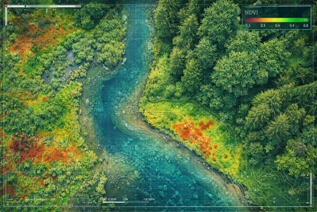
| NDVI / Multispectral Maps | GeoTIFF / SHP | Vegetation health analysis and habitat monitoring |
Achievable Accuracy
| Parameter | Typical Accuracy | Depends On |
|---|---|---|
| Horizontal Accuracy | ±2–4 cm | Flight altitude and GCP density |
| Vertical Accuracy | ±3–6 cm | Terrain complexity and sensor type |
Key Advantages
- Non-invasive ecological assessment
- High-resolution vegetation and water health analysis
- Early identification of environmental risks
- Enables predictive sustainability and flood planning
- Improves regulatory compliance success rates
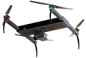
Compatible Drone Platforms
- Enterprise Workhorse (Skywing 90)
- VTOL (Sentinel)
- Compact Survey Drones
Supported Sensors / Payloads
- Multispectral Cameras
- LiDAR Sensors
- RGB Mapping Cameras
- Thermal Sensors
Industry Segments Benefited
- Infrastructure Development
- Mining & Quarrying
- Energy & Utilities
- Smart Cities
- Real Estate
- Environmental Conservation