In the modern infrastructure landscape, the project cycle is a data-driven journey that prioritizes precision and transparency. It begins with Pre-Construction Analysis, where the project’s viability is stress-tested against economic and technical constraints, alongside Environmental Impact Studies that evaluate ecological risks to ensure long-term sustainability. As the project enters the design phase, 3D Modelling and BIM Integration create a sophisticated “digital twin,” allowing teams to identify structural conflicts virtually before any physical work begins. During the execution phase, the cycle is monitored through Regular Aerial Updates—typically via drones—to provide high-definition site visibility. This data is then synthesised into Visual Progress Reports, which serve as the primary source of truth for stakeholders to track milestones, manage budgets, and ensure that the physical build aligns perfectly with the digital plan.
Visual Progress Reports
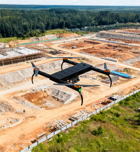
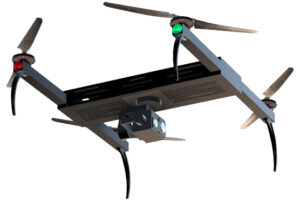
Visual Progress Reports using Drones
Overview
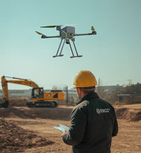
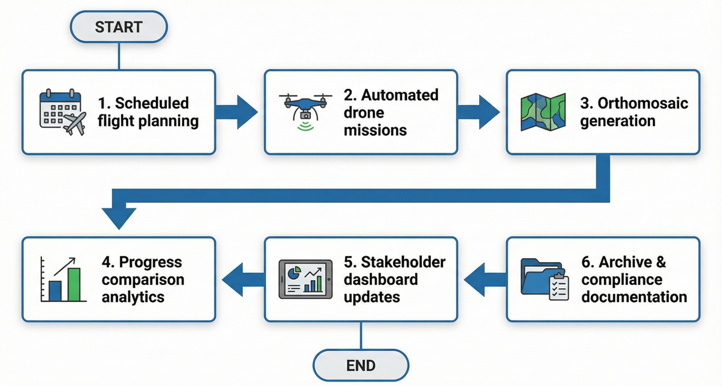
Visual Progress Reports transform raw drone data into professional-grade photo, video, orthomosaic, and 3D model deliverables that clearly communicate project progress to clients, consultants, and stakeholders. This application establishes a single visual source of truth for milestone verification, billing validation, contractor accountability, and investor communication—ensuring measurable and transparent reporting throughout the project lifecycle.
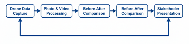
Process Flow
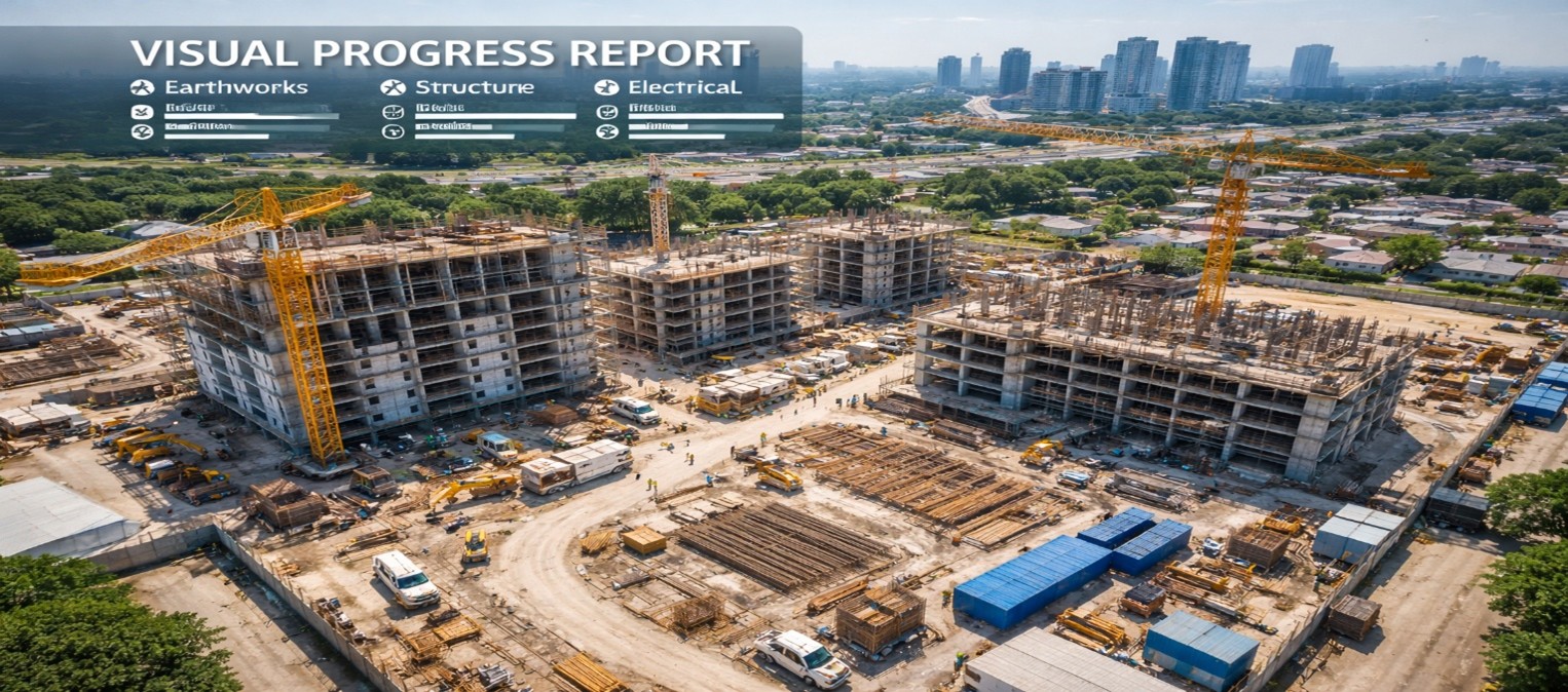
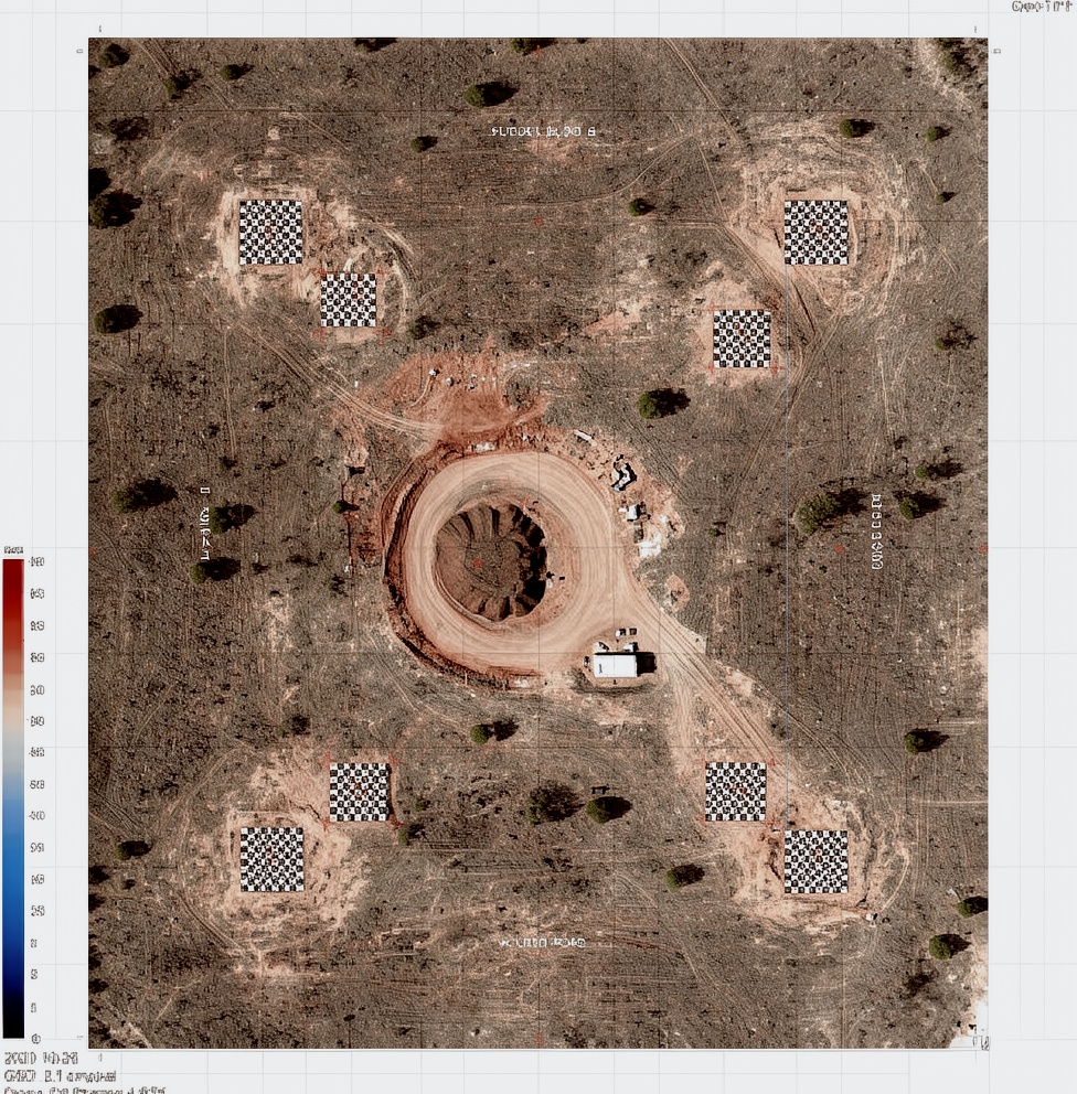
Reference Image
Relevant Outcomes / Deliverables
| Deliverable |
Format |
Usage |
| Before / After Comparisons |
JPG / MP4 |
Milestone validation and stakeholder reporting |
| Orthomosaic Maps |
GeoTIFF |
Accurate surface measurement and progress tracking |
| 3D Models |
OBJ / FBX |
Virtual walkthroughs and volumetric analysis |
| Progress Report |
PDF |
Client submission and billing documentation |
Achievable Accuracy
| Parameter |
Typical Accuracy |
Depends On |
| Horizontal Accuracy |
±1.5–3 cm |
RTK positioning & GCP deployment |
| Vertical Accuracy |
±2.5–5 cm |
Sensor quality & terrain conditions |
Key Advantages
- Clear, measurable project progress visibility
- Faster client approvals and billing cycles
- Improved transparency and stakeholder trust
- Professional and standardized reporting format
- Reduction in disputes and claim conflicts
Compatible Drone Platforms
- Skywing 90
- Sentinel VTOL
- Professional Quadcopters
Supported Sensors / Payloads
- High-Resolution RGB Cameras
- Thermal Cameras (for energy and utility monitoring)
Industry Segments Benefited
- Infrastructure Projects
- Commercial Construction
- Smart Cities
- Energy & Utilities
- Real Estate Development
Regular Aerial Updates
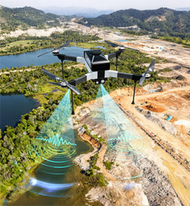
Regular Aerial Updates using Drones
Overview
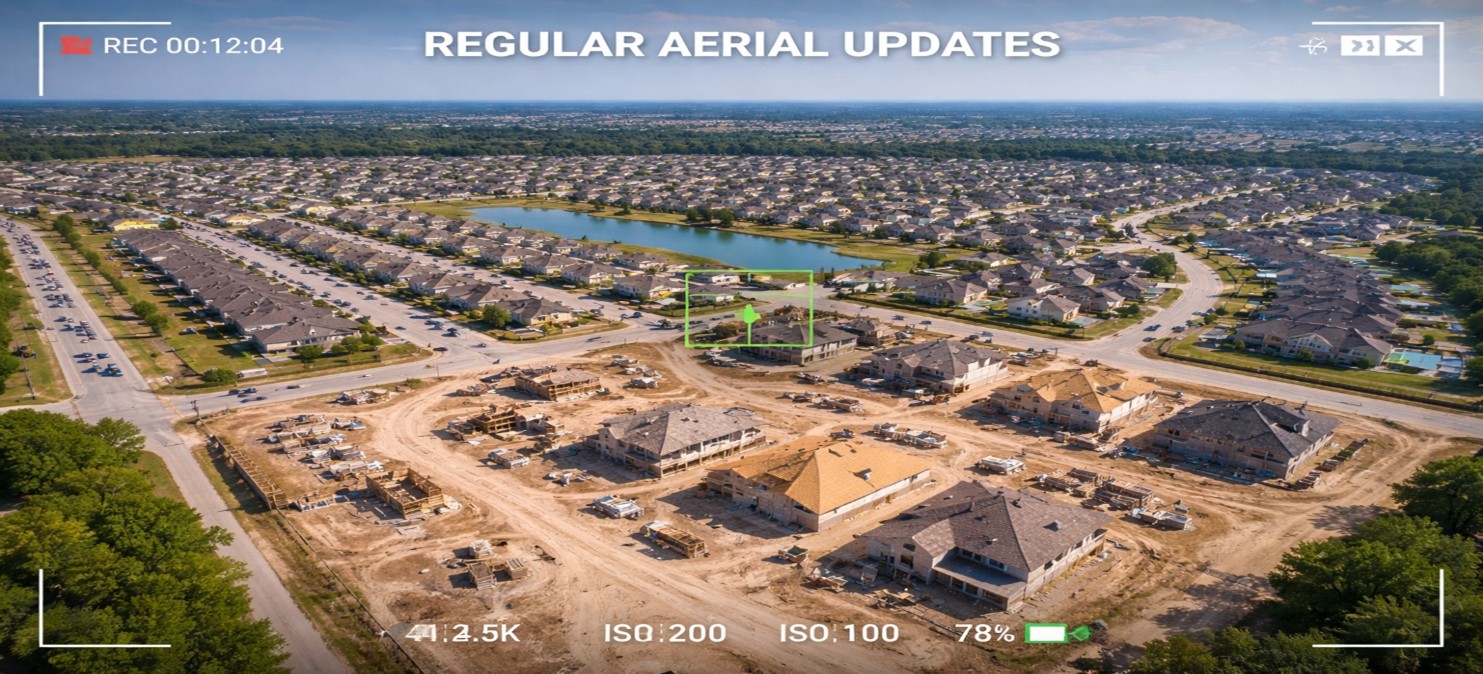
Regular Aerial Updates deliver high-frequency visual intelligence through scheduled weekly or monthly drone flights, enabling management teams to monitor construction progress, safety compliance, and site utilization in near real time. This application replaces manual reporting with objective, measurable, and verifiable visual data, ensuring transparent project tracking and improved operational control.
Process Flow
Reference Image
Relevant Outcomes / Deliverables
| Deliverable |
Format |
Usage |
| Time-Series Orthomosaics |
GeoTIFF |
Visual progress tracking and milestone validation |
| 3D Site Models |
OBJ / SKP |
Construction stage analysis and volumetric assessment |
| Site Change Logs |
PDF |
Weekly or monthly reporting documentation |
Achievable Accuracy
| Parameter |
Typical Accuracy |
Depends On |
| Horizontal Accuracy |
±1.5–3 cm |
RTK positioning and image overlap |
| Vertical Accuracy |
±2.5–5 cm |
Terrain conditions and Ground Control Points (GCPs) |
Key Advantages
- Eliminates blind spots in project monitoring
- Provides near real-time site intelligence
- Improves schedule adherence and transparency
- Enhances safety compliance and accountability
- Reduces costly rework through early issue detection
Compatible Drone Platforms
- Skywing90
- Sentinel VTOL
- Compact Enterprise UAVs
Supported Sensors / Payloads
- RGB Cameras
- Thermal Sensors
- RTK GNSS Modules
Industry Segments Benefited
- Construction
- Infrastructure
- Oil & Gas
- Renewable Energy
- Smart Cities
Environmental Impact Studies
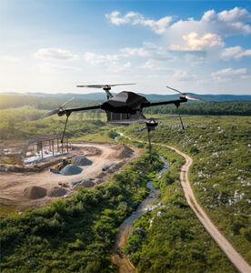
Environmental Impact Studies using Drones
Overview
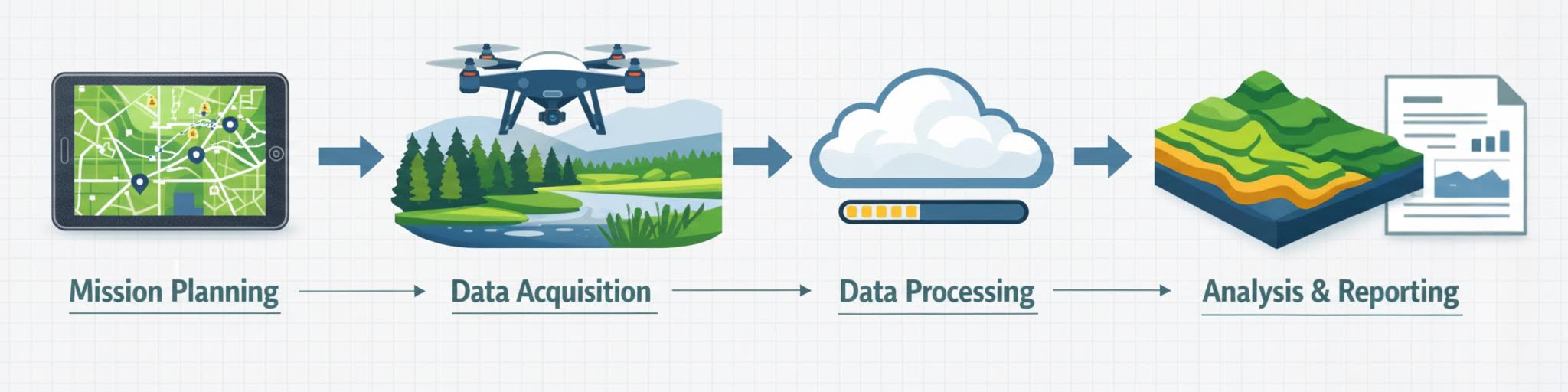
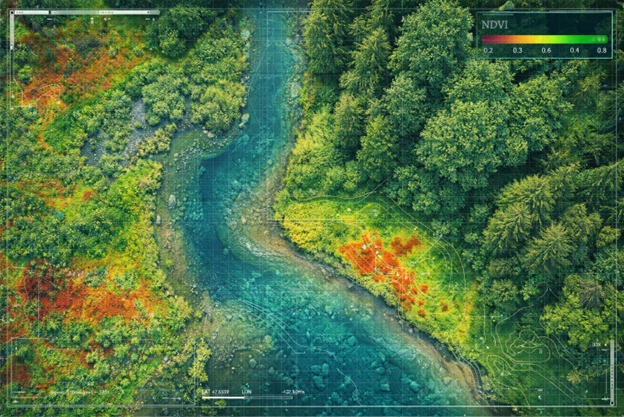
In 2025, Environmental Impact Studies using Drones have transitioned from experimental tools to the industry standard for high-precision ecological monitoring. These unmanned platforms provide a non-invasive method to collect granular data on air quality, vegetation health, and wildlife populations without disturbing local habitats. Equipped with multispectral and LiDAR sensors, drones generate Digital Twins of ecosystems that offer up to 100x more detail than traditional satellite imagery. They enable researchers to access hazardous or remote environments such as wetlands and contaminated zones, ensuring human safety while identifying invisible threats like methane leaks or invasive species. This technology transforms environmental assessments into a dynamic, real-time process, enabling predictive modelling for flood risks, soil erosion, and sustainability planning. Ultimately, drones empower stakeholders to balance industrial development with strong conservation and regulatory compliance goals.
Process Flow
Reference Image
Relevant Outcomes / Deliverables
| Deliverable |
Format |
Usage |
| Orthomosaic Map |
GeoTIFF |
Ecological baseline documentation |
| Water Body Mapping Report |
PDF / SHP |
Floodplain and contamination risk assessment |
| Change Detection Report |
PDF |
Environmental impact comparison over time |
| Environmental Compliance Report |
PDF |
Documentation for regulatory approvals |
| Digital Terrain Model (DTM) |
DEM / TIF / DXF |
Erosion modelling and drainage risk mapping |
| NDVI / Multispectral Maps |
GeoTIFF / SHP |
Vegetation health analysis and habitat monitoring |
Achievable Accuracy
| Parameter |
Typical Accuracy |
Depends On |
| Horizontal Accuracy |
±2–4 cm |
Flight altitude and GCP density |
| Vertical Accuracy |
±3–6 cm |
Terrain complexity and sensor type |
Key Advantages
- Non-invasive ecological assessment
- High-resolution vegetation and water health analysis
- Early identification of environmental risks
- Enables predictive sustainability and flood planning
- Improves regulatory compliance success rates
Compatible Drone Platforms
- Enterprise Workhorse (Skywing 90)
- VTOL (Sentinel)
- Compact Survey Drones
Supported Sensors / Payloads
- Multispectral Cameras
- LiDAR Sensors
- RGB Mapping Cameras
- Thermal Sensors
Industry Segments Benefited
- Infrastructure Development
- Mining & Quarrying
- Energy & Utilities
- Smart Cities
- Real Estate
- Environmental Conservation
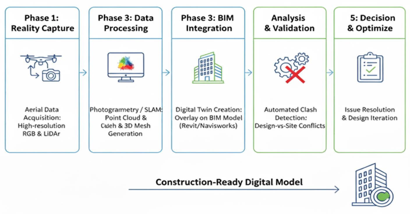
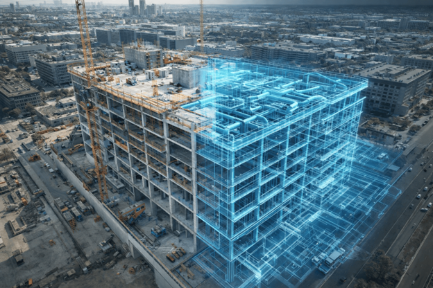
3D Modeling and BIM Integration
3D Modelling and BIM Integration using Drones
Overview
This application involves using drones to capture high-density spatial data to create high-fidelity 3D Digital Twins of a project site. By integrating this real-world data into Building Information Modelling (BIM) software, project teams can overlay planned architectural designs onto the actual terrain. This ensures that the digital blueprint and the physical site are perfectly synchronised, enabling automated error detection, design validation, and seamless coordination before and during construction.
Process Flow
Reference Image
Relevant Outcomes / Deliverables
| Deliverable |
Format |
Usage |
| Orthomosaic Map |
GeoTIFF |
Provides a precise 2D base map for site planning and logistics layout |
| 3D Textured Mesh |
OBJ / FBX / SKP |
Facilitates stakeholder approvals through realistic virtual site walkthroughs |
| Contour Map |
SHP / DXF / DWG |
Integrated into CAD to define foundation elevations and grading requirements |
| Survey Report |
PDF / CSV |
Quantifies on-site material stockpiles for accurate cost and haulage estimation |
| Digital Terrain Model (DTM) |
DEM / TIF / DXF |
Used for precise earthwork cut-and-fill calculations and drainage design |
| BIM Overlay |
NWD / RVT |
Validates that the digital design aligns perfectly with real-world site constraints |
Achievable Accuracy
| Parameter |
Typical Accuracy |
Depends On |
| Absolute Horizontal Accuracy |
1–3 cm |
Use of RTK/PPK GNSS or accurately surveyed Ground Control Points (GCPs) |
| Absolute Vertical Accuracy |
2–5 cm |
Number and distribution of GCPs or LiDAR sensor precision |
Key Advantages
- Provides high-precision as-built reality capture
- Enables automated clash detection between planned designs and real-world site conditions
- Minimizes costly rework by identifying inconsistencies early
- Supports real-time design-to-site validation and coordination
Compatible Drone Platforms
- Enterprise Workhorse (Skywing 90)
- VTOL (Sentinel)
- Compact Professional Platforms
Supported Sensors / Payloads
- Photogrammetry (High-Resolution RGB Sensors)
- LiDAR (Light Detection and Ranging)
- Thermal Sensors
Industry Segments Benefited
- Civil Engineering & Infrastructure
- Energy & Utilities
- Real Estate & Land Development
- Mining & Quarrying
- Commercial Construction
- Oil & Gas
- Urban Planning
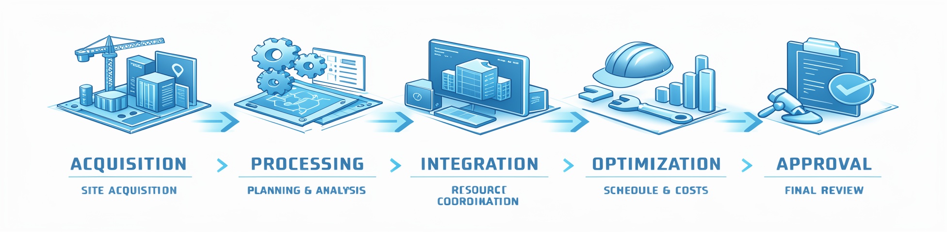
Pre-Construction Analysis
Pre-Construction Analysis using Drones
Overview
In the modern infrastructure lifecycle, Pre-Construction Analysis using Drones serves as the critical intelligence layer that bridges the gap between conceptual design and physical reality. By deploying Unmanned Aerial Vehicles (UAVs) equipped with high-resolution sensors and LiDAR technology, project teams can conduct comprehensive site characterizations with unprecedented speed and accuracy. This application transforms traditional surveying into a high-fidelity Reality Capture process, providing the data necessary to de-risk investments, ensure environmental compliance, and establish a precise digital baseline for the construction phases to follow.
Process Flow
Reference Image
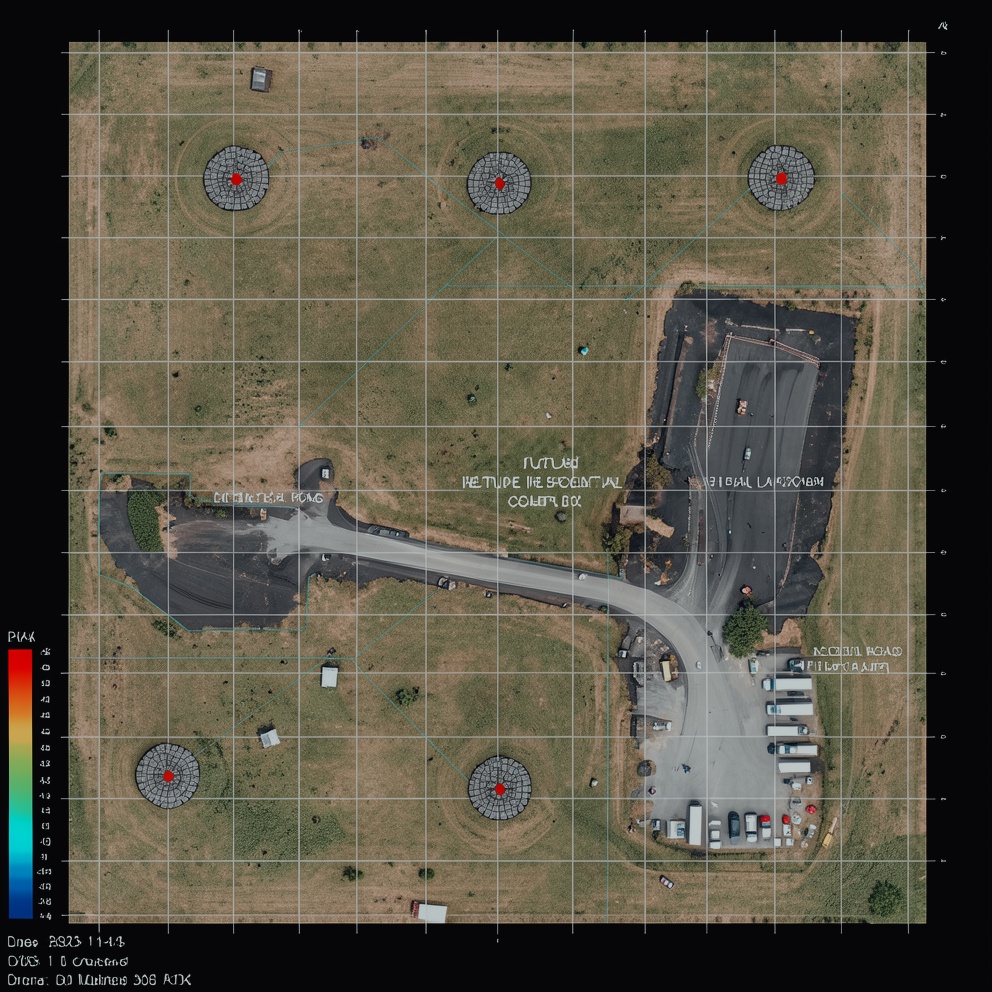
Relevant Outcomes / Deliverables
| Deliverable |
Format |
Usage |
| Orthomosaic Map |
GeoTIFF |
Precise site mapping, measurements, and baseline documentation |
| DSM (Digital Surface Model) |
GeoTIFF (.tif) |
Initial site visualization and identification of surface obstructions |
| Contour Map |
DWG / SHP |
Drainage analysis, grading plans, and slope stability assessment |
| Survey Report |
PDF / CSV |
Comprehensive project documentation and compliance record |
| Digital Terrain Model (DTM) |
GeoTIFF / DXF |
Cut/fill calculations and earthwork volume estimates |
| 3D Point Cloud |
LAS / LAZ |
CAD/BIM integration for architectural and structural design |
Achievable Accuracy
| Parameter |
Typical Accuracy |
Depends On |
| Horizontal Accuracy |
±1.5–3 cm |
GSD, image overlap, and sensor resolution |
| Vertical Accuracy |
±2.5–5 cm |
Flight altitude, GCP density, and ground cover conditions |
Key Advantages
- Provides centimeter-accurate geospatial data
- Generates 3D terrain models that eliminate site “unknowns”
- Significantly faster than traditional ground surveying
- Enables precise volumetric calculations and early clash detection
- Helps prevent budget overruns before mobilization begins
Compatible Drone Platforms
- Workhorses (Skywing90)
- VTOL (Sentinel)
- Autonomous & Secure Systems
Supported Sensors / Payloads
- High-resolution RGB Cameras (20–45 MP)
- LiDAR (Essential for terrain mapping beneath vegetation cover)
Industry Segments Benefited
- Civil Engineering & Infrastructure
- Energy & Utilities
- Real Estate & Land Development
- Mining & Quarrying
- Environmental & Conservation Projects