
Hazard Identification using Drones
Overview
Hazard Identification using Drones provides continuous safety intelligence by monitoring unsafe zones, unstable terrain, excavation edges, material stockpiles, and active worker movement across project sites. High-resolution aerial data enables safety teams to proactively detect risks such as slope instability, open trenches, congested operational zones, falling hazards, and PPE non-compliance before they escalate into serious accidents.
This application creates a dynamic Safety Digital Twin of the site, enabling predictive risk modelling, intelligent safety zoning, and compliance documentation that significantly reduces incident rates while strengthening overall worker safety culture.
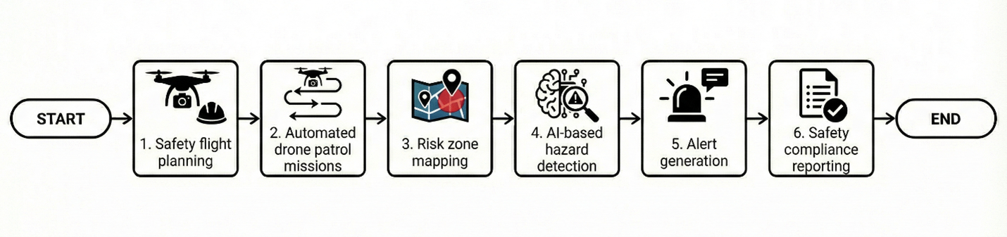
Process Flow
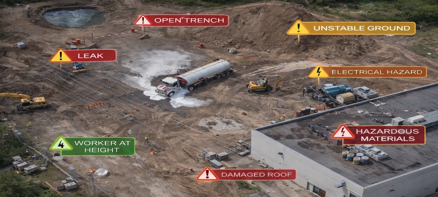
Reference Image
Relevant Outcomes / Deliverables
| Deliverable | Format | Usage |
|---|---|---|
| Hazard Zone Maps | GeoTIFF / SHP | Risk area demarcation and safety zoning |
| Safety Violation Reports | Compliance audits and documentation | |
| PPE Detection Logs | CSV / PDF | Workforce safety monitoring and tracking |
Achievable Accuracy
| Parameter | Typical Accuracy | Depends On |
|---|---|---|
| Positional Accuracy | ±2–4 cm | RTK positioning & Ground Control Point (GCP) density |
| Detection Precision | 90–96% | AI model quality, training dataset & site conditions |
Key Advantages
- Proactive accident prevention and hazard mitigation
- Improves regulatory and site safety compliance
- Enables predictive and data-driven risk planning
- Reduces insurance liabilities and legal exposure
- Creates structured digital safety audit trails
Compatible Drone Platforms
- Enterprise Surveillance UAVs
- VTOL Long-Endurance UAVs
- Compact Inspection Drones
Supported Sensors / Payloads
- High-Resolution RGB Cameras
- AI Vision Modules
- RTK GNSS Systems
Industry Segments Benefited
- Construction
- Infrastructure
- Mining
- Oil & Gas
- Smart Cities