Drone-Based Volume Calculation & Stockpile Inventory Monitoring
Overview
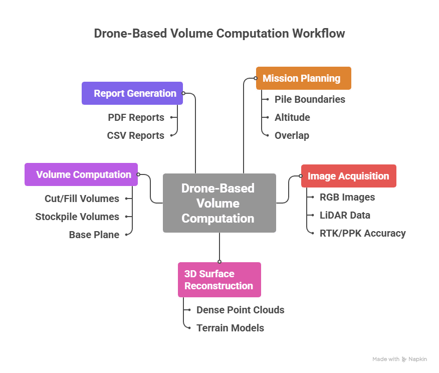
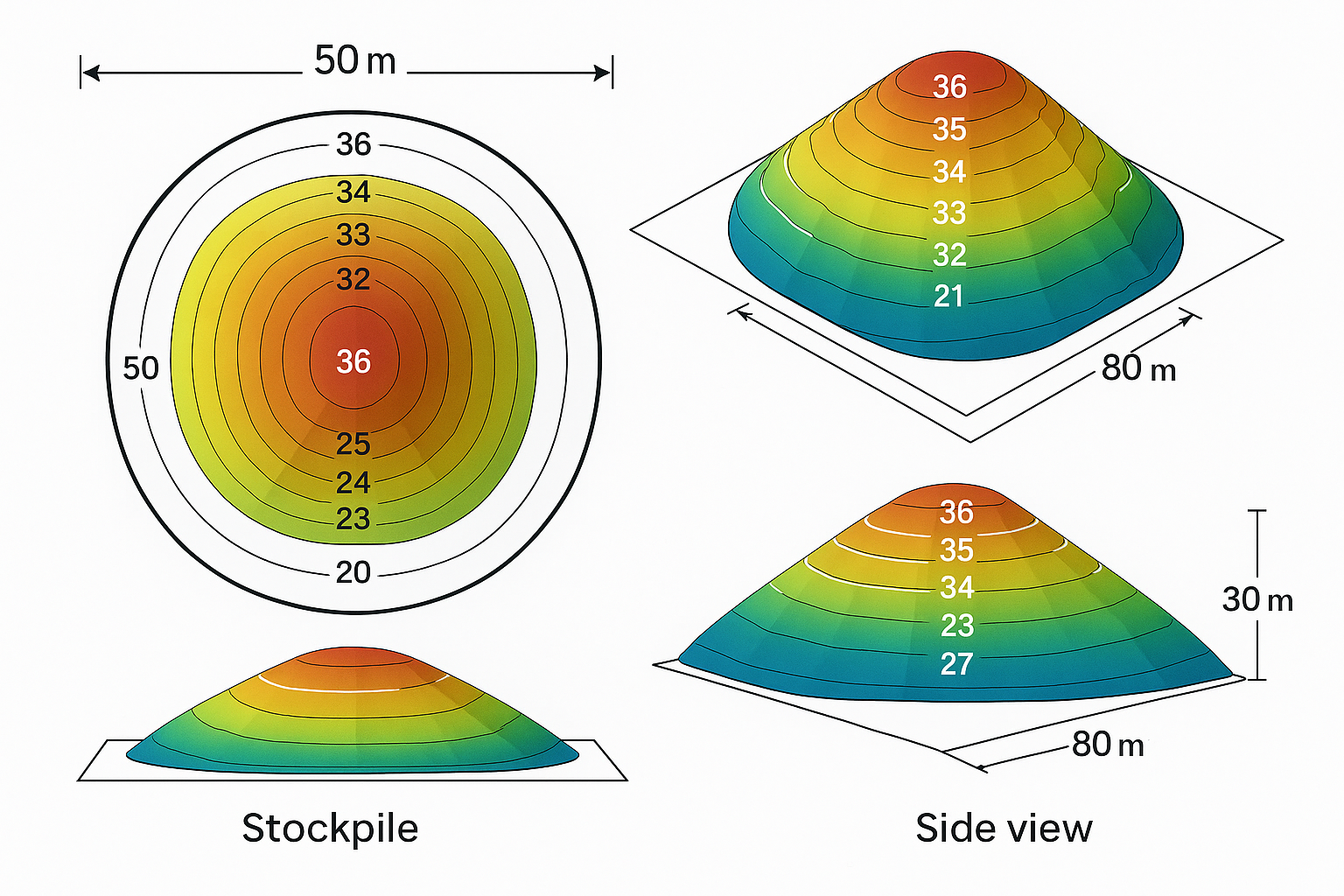
Drone photogrammetry provides a fast, safe, and accurate way to measure the volumes of excavated materials, overburden, or stockpiles. By capturing aerial imagery and generating precise 3D surface models, AKSI drones deliver volumetric data within ±3% accuracy. This enables mine operators to monitor production, optimize material handling, and maintain up-to-date inventory records without halting operations or exposing staff to hazardous zones.
Process Flow
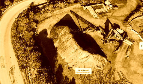
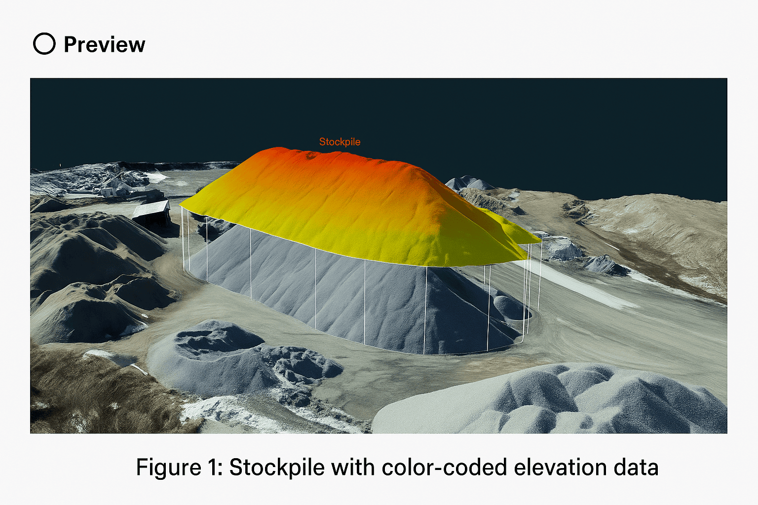
Reference Image
Relevant Outcomes / Deliverables
| Deliverable | Format | Usage |
|---|---|---|
| 3D Surface Model | OBJ / LAS | Volume analysis |
| Volume Report | PDF / CSV | Inventory and audit |
| Orthomosaic Map | GeoTIFF | Reference base map |
| Cut/Fill Analysis | DXF / SHP | Earthwork planning |
Achievable Accuracy
| Parameter | Typical Accuracy | Depends On |
|---|---|---|
| Volume Accuracy | ±3 – 5 % | Image overlap, surface texture |
| Spatial Accuracy | ±3 cm | RTK/PPK and GCP placement |
Key Advantages
- Rapid, contact-free measurements
- Reduces manual survey errors and labor time
- Enables real-time inventory tracking
- Ideal for regulatory and financial audits
Compatible Platforms
- Multirotor (Skywing90)
- VTOL (Sentinel) for large-size quarry
Supported Sensors / Payloads
- High-resolution RGB Cameras
- LiDAR payloads
- RTK / PPK modules
Industry Segments Benefited
- Mining
- Cement Plants
- Construction Material Depots
- Logistics Yards
No sub drone applications found for this category.