Aerial Environmental Monitoring for Sustainable Mining Compliance
Overview
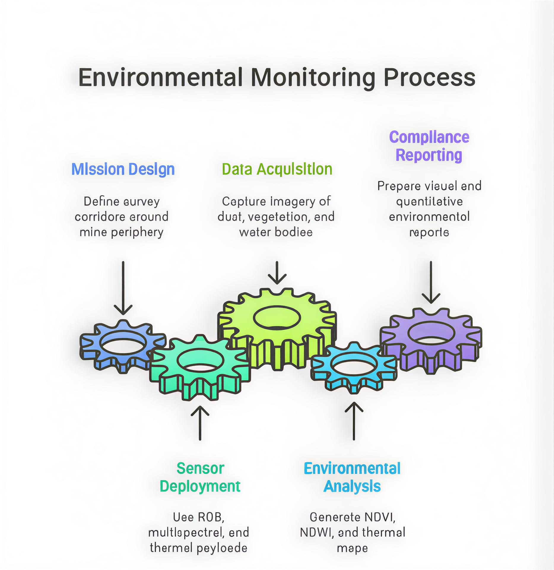
Environmental compliance is a critical aspect of modern mining operations. Drones equipped with multispectral and thermal sensors enable precise monitoring of dust levels, water run-off, and vegetation health around mining sites. These aerial systems help operators identify pollution sources, track reclamation progress, and generate scientific, audit-ready reports aligned with MoEFCC and CPCB regulatory standards.
Process Flow
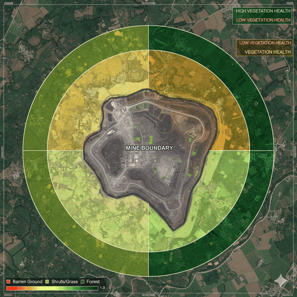
Reference Image
Relevant Outcomes / Deliverables
| Deliverable | Format | Usage |
|---|---|---|
| NDVI / NDWI Maps | GeoTIFF | Vegetation & water health assessment |
| Dust Dispersion Map | GeoTIFF / PDF | Pollution control planning |
| Thermal Imagery | JPG / TIFF | Leakage and temperature analysis |
| Compliance Report | Submission to environmental authorities |
Achievable Accuracy
| Parameter | Typical Accuracy | Depends On |
|---|---|---|
| Spectral Resolution | 5 nm bands | Sensor quality |
| Spatial Accuracy | ±5 cm | RTK / GCPs |
Key Advantages
- Automated environmental compliance monitoring
- Early detection of dust and pollution sources
- Quantifies vegetation stress for reclamation tracking
- Provides audit-ready evidence for CPCB & MoEFCC reporting
Compatible Drone Platforms
- Multirotor drones for localized surveys
- Fixed-wing drones for wide-area environmental mapping
Supported Sensors / Payloads
- RGB Cameras
- Multispectral Sensors
- Thermal Sensors
- Gas Sensors (optional)
Industry Segments Benefited
- Mining
- Environmental Consultancy
- Regulatory Agencies
- Sustainability Auditors
Case Study
An open-cast bauxite mine deployed multispectral drones to assess vegetation health and track dust plumes. NDVI-based analytics supported a successful environmental audit submission to the State Pollution Control Board, improving compliance confidence and reclamation planning.
No sub drone applications found for this category.