Disaster Assessment & Relief
Overview
Disaster Assessment and Relief leverages drone-based remote sensing and AI analytics to evaluate the extent and severity of natural disasters such as floods, droughts, cyclones, and storms. High-resolution aerial data enables rapid and accurate mapping of affected areas, identification of damaged assets, and estimation of crop and property losses. This supports government agencies, insurance firms, and relief organizations in making evidence-based decisions, accelerating compensation processes, and optimizing the distribution of emergency aid. The approach significantly reduces assessment time, enhances transparency, and ensures timely support for impacted communities.
Process Flow


The process begins with the occurrence of a disaster such as a flood, drought, or storm, which triggers the need for rapid assessment. Drones are immediately deployed to the affected regions to quickly capture real-time data, avoiding delays associated with manual surveys. During data acquisition, the drones gather high-resolution imagery, GPS information, and multispectral data essential for detailed analysis. This collected data is then processed to detect and map damaged crops, properties, and affected zones, providing a visual understanding of the disaster’s impact. Based on these mapped insights, the extent of losses is quantified in terms of crop loss percentages, affected acreage, and estimated financial damage. The quantified results feed into automated report generation, producing GIS maps, comparison visuals, and structured damage summaries. These reports undergo validation and approval by authorities or insurance agencies to ensure accuracy and authenticity. Once verified, the findings support compensation, insurance claims, and relief distribution to affected beneficiaries. Finally, post-relief drone monitoring is carried out to track recovery progress, evaluate the effectiveness of aid, and support ongoing rehabilitation efforts.
Reference Image

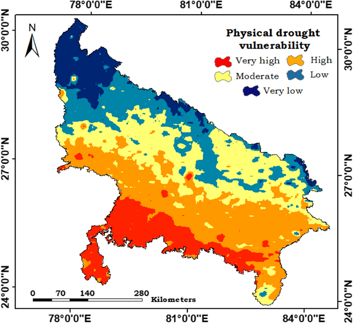
Image Source: https://link.springer.com/article/10.1007/s11356-024-33776-y
Flood Risk Mapping – LandHawk
Relevant Outcomes / Deliverables
- High-resolution disaster impact maps (flood extent, drought severity, storm damage).
- Crop damage assessment reports with quantified loss percentages.
- Property and infrastructure damage evaluation sheets.
- GIS-based zonal classification of affected, moderately affected, and severely affected areas.
- Insurance-ready documentation for crop loss and property compensation.
- Government relief distribution reports and beneficiary prioritization lists.
- Digital dashboards summarizing damage statistics and affected locations.
- Post-relief monitoring reports tracking recovery and rehabilitation progress.
Achievable Accuracy
| Assessment Type | Achievable Accuracy |
|---|---|
| Crop Damage Detection | 95% |
| Flood Extent Mapping | 98% |
| Drought Severity Assessment | 92% |
| Property Damage Identification | 95% |
| Loss Quantification | ±10% |
| Geolocation Accuracy (RTK) | 2–5 cm positional accuracy |
Key Advantages
- Rapid assessment of large disaster-affected areas within hours.
- High accuracy in detecting crop, property, and infrastructure damage.
- Reduced human risk by eliminating manual surveys in hazardous zones.
- Objective, evidence-based reports minimizing insurance and compensation disputes.
- Cost-effective alternative to traditional field inspection methods.
- Real-time insights enabling faster decision-making by authorities.
- Scalable coverage for villages and districts using automated drone missions.
- Enhanced transparency through GIS maps and digital documentation.
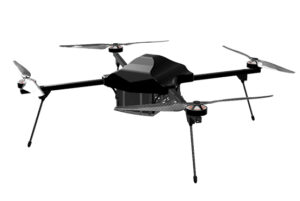
Compatible Drone Platforms
- Drishti
- Drishti Pro
Supported Sensors / Payloads
- RGB + Thermal camera
- GNSS module for high-precision mapping
- Cloud-based data processing and report generation
Industry Segments Benefited
- Agriculture & Agritech
- Insurance & Risk Assessment
- Government & Disaster Management Agencies
- Rural Development Departments
- Environmental & Climate Monitoring
- Infrastructure & Public Utilities
- Humanitarian & Relief Organizations (NGOs)
- Forestry & Land Management