Bridge and Roadway Structural Inspections using Drones
Overview
Drone-based bridge and roadway inspections revolutionize infrastructure maintenance by providing a non-contact, high-resolution assessment of structural health. Drones equipped with optical, thermal, or LiDAR sensors capture detailed visuals of cracks, corrosion, joint misalignment, or surface degradation — all without traffic disruption. This technology ensures safety, reduces downtime, and enables proactive maintenance planning through precise visual documentation and analytics.
Process Flow

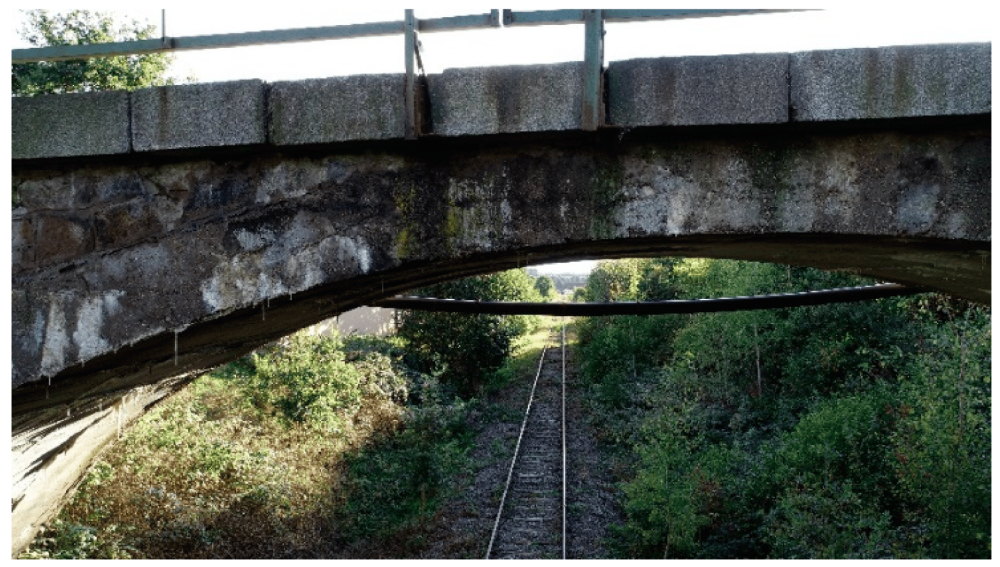
Reference Image

Relevant Outcomes / Deliverables
| Deliverable | Format | Usage |
|---|---|---|
| Visual Inspection Report | PDF / Web Dashboard | Maintenance planning |
| Thermal Map | JPG / GeoTIFF | Detect material fatigue & water ingress |
| 3D Model / Point Cloud | OBJ / LAS | Structural modeling & deformation study |
| Video Footage | MP4 | Documentation & monitoring |
Achievable Accuracy
| Parameter | Typical Accuracy | Depends On |
|---|---|---|
| Crack Detection | up to 1–2 mm | Camera resolution, distance |
| Dimensional Accuracy | ±2–5 cm | Sensor calibration, flight stability |
Key Advantages
- Non-contact, safe inspection of inaccessible areas
- No traffic disruption or scaffolding required
- Detects micro-cracks and corrosion early
- Enables digital archiving and predictive maintenance
Compatible Drone Platforms
- Multirotor (Skywing90) for close-up inspection
- Tethered drones for long-duration bridge surveys
Supported Sensors / Payloads
- RGB / Zoom Cameras (45× optical zoom)
- Thermal / IR Sensors
- LiDAR (optional for structural 3D modeling)
Industry Segments Benefited
- Highway Authorities
- PWD
- Smart City Agencies
- Infrastructure Consultants
- Bridge Maintenance Firms