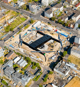
Drone-based post-construction assessment and handover provides a highly accurate, visually rich, and verifiable record of completed infrastructure projects. Through as-built verification, drones capture high-resolution imagery and 3D models that are compared against original design blueprints or BIM files to confirm dimensional accuracy, detect deviations, and validate construction quality before final approval. This ensures compliance, accelerates quality checks, and reduces rework. For client handover documentation, drones generate comprehensive aerial photo sets, 4K videos, orthomosaics, and interactive 3D digital twins—creating a professional, audit-ready package that showcases the final project in its entirety. These deliverables provide clients with clear visual evidence of completion, support future maintenance planning, and enhance transparency. Combined, drone-enabled verification and documentation streamline the final stages of construction, improving communication, reducing delays, and delivering a superior handover experience.
Client Handover Documentation
Aerial Documentation & Digital Handover Packages
Overview
Drone-based client handover documentation provides a complete visual and spatial record of project completion.Aerial imagery, videos, and 3D models capture the finished site in remarkable detail, forming part of the final deliverables to clients, investors, or regulatory authorities. This creates a permanent, audit-ready, and visually rich record showcasing the quality, scale, and accuracy of the completed infrastructure.
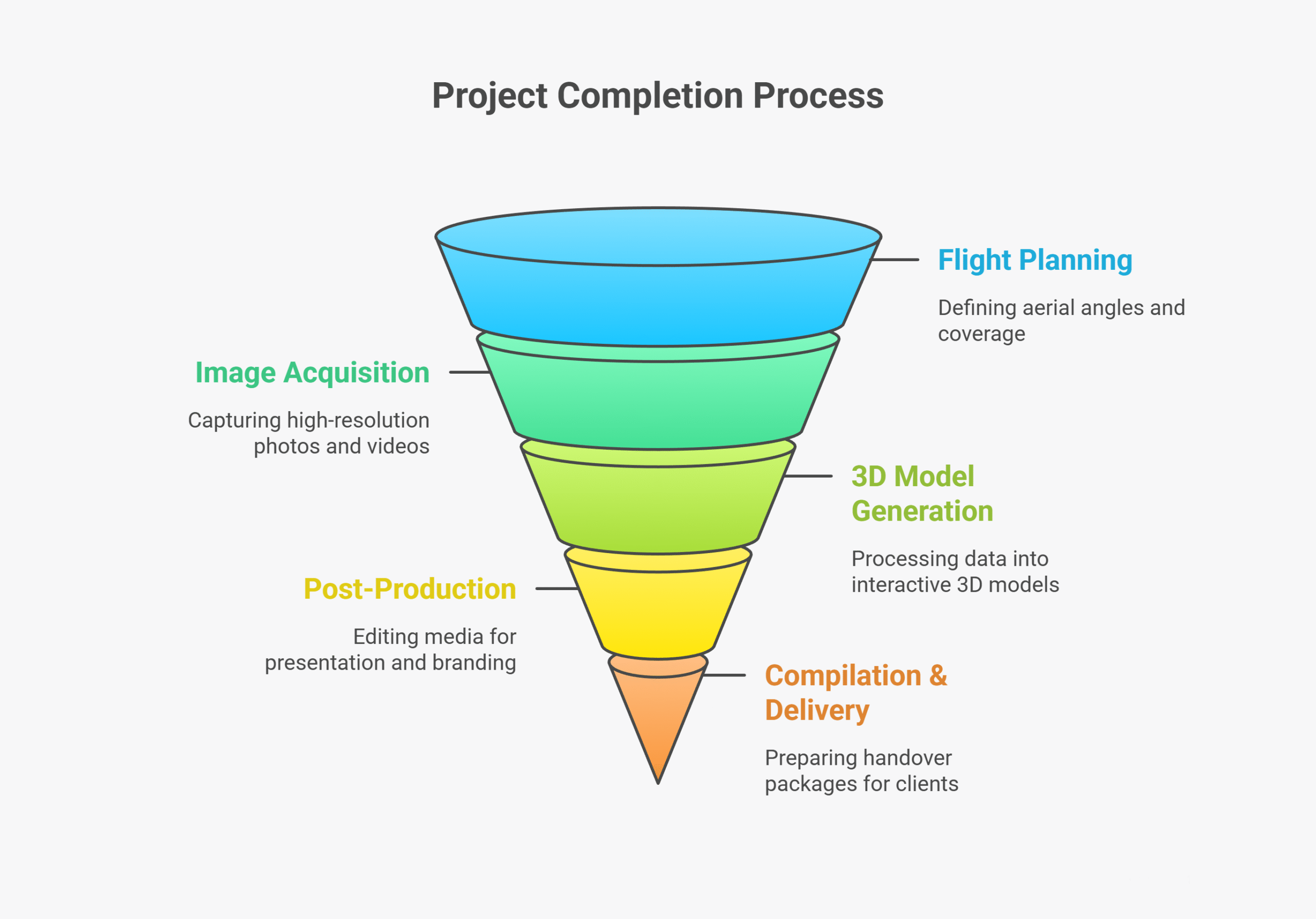
Process Flow
Relevant Outcomes / Deliverables
| Deliverable | Format | Usage |
|---|---|---|
| Aerial Photographs | JPG / PNG | Project archive & presentation |
| 4K Video Tour | MP4 | Client presentation & marketing |
| 3D Model / Digital Twin | OBJ / GLTF / Web Viewer | Interactive visualization |
| Final Documentation Report | Official handover record |
Achievable Accuracy
| Parameter | Typical Accuracy | Depends On |
|---|---|---|
| Visual Accuracy | Photorealistic (1 cm/pixel) | Camera quality and flight altitude |
| Geospatial Accuracy | ±5 cm (optional RTK) | GPS and GCP integration |
Key Advantages
- Professional visual handover for clients and investors
- Permanent digital record for future reference
- Enhances transparency and brand value
- Supports regulatory and contractual documentation
Compatible Drone Platforms
- Multirotor with stabilized gimbal cameras (Skywing90)
- FPV drones (optional) for dynamic fly-through videos
Supported Sensors / Payloads
- High-Resolution RGB Cameras (20–48 MP)
- Cine-grade Video Cameras (4K / 6K)
Industry Segments Benefited
- Construction Developers
- Real Estate Companies
- Infrastructure Consultants
- Government Projects
As-Built Verification
As-Built Verification & Design Validation using Drones
Overview
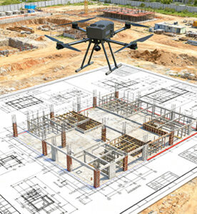
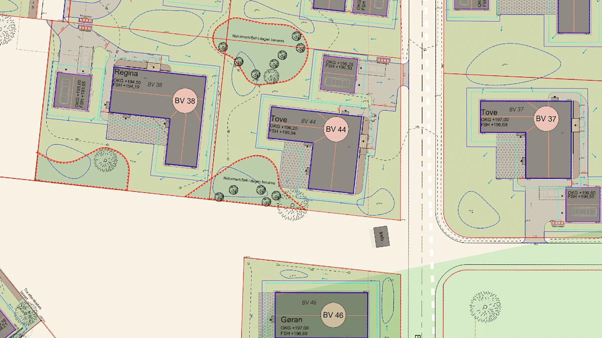
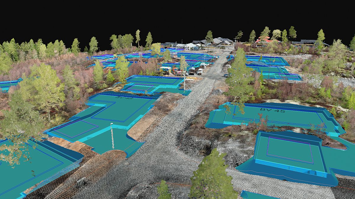
As-built verification ensures that a constructed structure precisely matches its design specifications. High-resolution drone imagery and 3D modeling allow engineers and project managers to compare actual site conditions with CAD or BIM blueprints. This digital validation process identifies deviations, dimensional mismatches, and missing components early—enabling faster rectification, accurate billing, and quality assurance before handover.
Process Flow

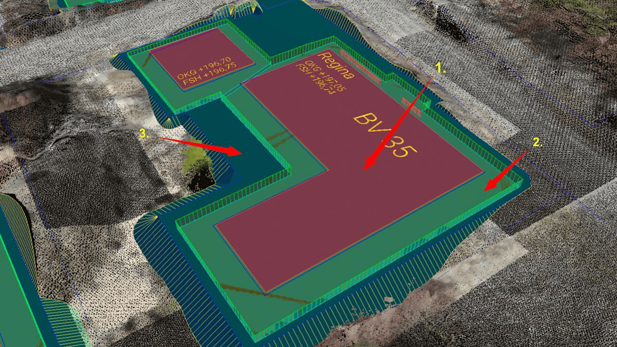
Reference Image
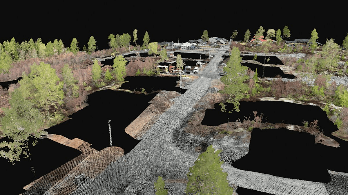 +
+

Relevant Outcomes / Deliverables
| Deliverable | Format | Usage |
|---|---|---|
| Orthomosaic Map | GeoTIFF | Surface reference for as-built analysis |
| 3D Model / Point Cloud | OBJ / LAS | Deviation measurement and BIM integration |
| Deviation Heat Map | GeoTIFF / PDF | Tolerance assessment |
| QA Report | PDF / CSV | Documentation for handover |
Achievable Accuracy
| Parameter | Typical Accuracy | Depends On |
|---|---|---|
| Horizontal Accuracy | ±2–3 cm | RTK positioning, GCP layout |
| Vertical Accuracy | ±5 cm | Flight altitude, sensor calibration |
| Deviation Detection | ±1–2 cm | Model resolution and alignment |
Key Advantages
- Ensures construction matches design before handover
- Accelerates quality control and compliance checks
- Reduces manual survey effort and human error
- Integrates directly with BIM and CAD systems
Compatible Drone Platforms
- Multirotor (Skywing90)
- VTOL (Sentinel)
Supported Sensors / Payloads
- High-resolution RGB Cameras (20–48 MP)
- LiDAR (optional for complex geometry)
Industry Segments Benefited
- Infrastructure Developers
- Construction Firms
- Smart City Projects
- Real Estate Consultants