
Thermal Imaging using Drones
Overview
Thermal Imaging using Drones introduces non-contact temperature-based diagnostics for construction, infrastructure, and industrial maintenance activities. By capturing infrared radiation, thermal UAV payloads identify insulation failures, moisture ingress, concealed water leaks, overloaded electrical circuits, and energy loss points that remain invisible to the naked eye.
This application supports preventive maintenance programs by detecting overheating equipment, HVAC inefficiencies, solar panel defects, and hidden structural moisture—preventing failures before they escalate into costly repairs, downtime, or safety hazards.
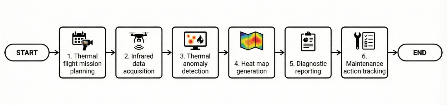
Process Flow
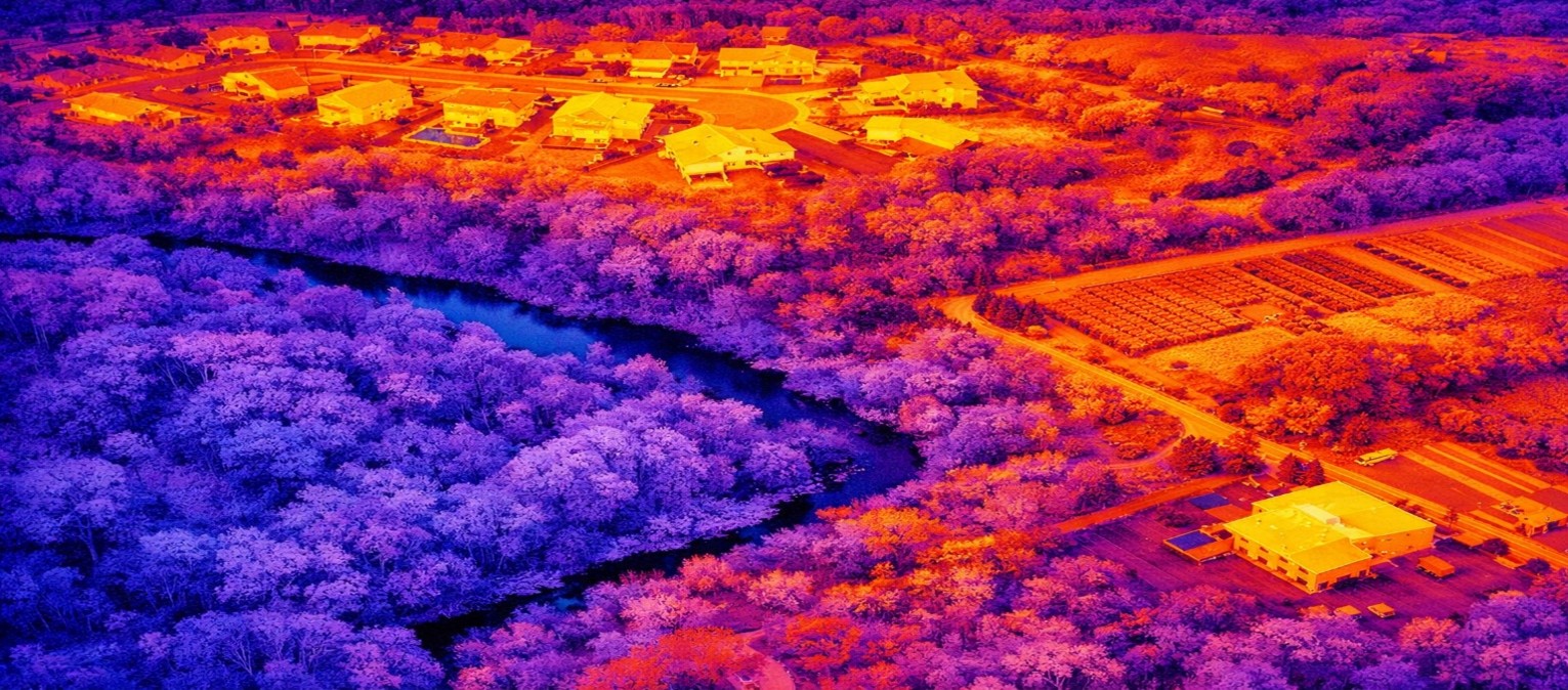
Reference Image
Relevant Outcomes / Deliverables
| Deliverable | Format | Usage |
|---|---|---|
| Thermal Heat Maps | Radiometric JPG / TIFF | Leak detection and hotspot identification |
| Electrical Hotspot Report | Preventive maintenance planning | |
| HVAC & Insulation Loss Maps | Energy efficiency and insulation audits |
Achievable Accuracy
| Parameter | Typical Accuracy | Depends On |
|---|---|---|
| Temperature Sensitivity | ±0.05–0.1°C | Sensor grade, emissivity settings & calibration |
| Positional Accuracy | ±2–5 cm | Flight stability & GNSS/RTK positioning |
Key Advantages
- Non-contact and safe diagnostics
- Early failure and overheating detection
- Improves safety and energy efficiency
- Reduces unplanned downtime and repair costs
- Supports ESG and sustainability compliance
Compatible Drone Platforms
- Enterprise Thermal UAVs
- VTOL Survey UAVs
- Compact Inspection Drones
Supported Sensors / Payloads
- Thermal Infrared Cameras
- RGB-Thermal Dual Sensors
Industry Segments Benefited
- Construction
- Power Utilities
- Renewable Energy
- Smart Buildings
- Oil & Gas
