
Defect Detection using Drones
Overview
Defect Detection using Drones combines UAV-based high-resolution data acquisition with AI-powered image analytics to automatically identify cracks, spalling, corrosion, uneven surfaces, coating failures, and material degradation. Advanced machine learning models process thousands of inspection images to detect and classify potential defects with greater consistency, objectivity, and speed compared to manual inspections.
This application enables large-scale asset condition screening, structured defect classification, and creation of digital defect inventories that support proactive maintenance planning and long-term lifecycle asset management.
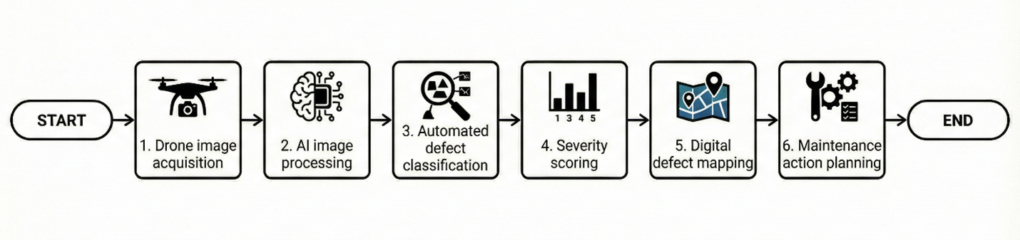
Process Flow
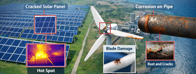
Reference Image
Relevant Outcomes / Deliverables
| Deliverable | Format | Usage |
|---|---|---|
| AI Defect Maps | SHP / GeoTIFF | Geospatial defect location tracking |
| Defect Inventory Database | CSV / PDF | Asset condition and maintenance records |
| Severity Ranking Report | Repair prioritization and budgeting |
Achievable Accuracy
| Parameter | Typical Accuracy | Depends On |
|---|---|---|
| Detection Precision | 90–98% | AI model training quality & dataset diversity |
| Positional Accuracy | ±2–4 cm | RTK positioning & Ground Control Points (GCPs) |
Key Advantages
- Automated and scalable defect identification
- Objective, repeatable, and data-driven inspections
- Faster large-area and vertical asset assessments
- Enables predictive and condition-based maintenance
- Creates a structured digital audit trail
Compatible Drone Platforms
- Skywing90
- SentinalVTOL
- Compact Enterprise UAVs
Supported Sensors / Payloads
- High-Resolution RGB Cameras
- Optical Zoom Cameras
- RTK GNSS Modules
Industry Segments Benefited
- Infrastructure
- Power Utilities
- Transportation
- Real Estate
- Smart Cities
- Oil & Gas

