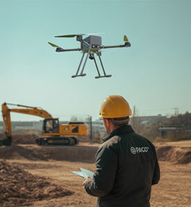
Drone-based topographic surveying and mapping integrate advanced technologies like LiDAR scanning, volumetric analysis, and 3D modeling to deliver precise, actionable insights for construction and infrastructure projects. LiDAR-equipped UAVs capture millions of elevation points even under vegetation, generating dense 3D point clouds and high-fidelity terrain models ideal for corridor mapping and design validation. Volumetric measurements enable accurate calculation of stockpiles, excavations, and earthwork quantities with centimeter-level accuracy, supporting cost control and inventory management. The captured imagery further combines into realistic 3D models or digital twins of project sites, offering powerful visualization for planning, progress monitoring, and simulation. Together, these drone-enabled capabilities transform traditional surveying into a faster, safer, and data-rich process that enhances engineering precision and decision-making from concept to completion
3D Modeling
3D Modeling & Digital Twin Creation
Overview
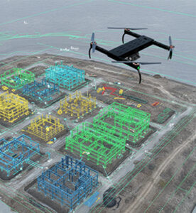
3D drone modeling creates realistic digital replicas of construction sites, buildings, or terrain for visualization, design validation, and simulation. By stitching overlapping aerial images into textured 3D meshes, stakeholders gain a clear spatial understanding of ongoing projects. These digital twins facilitate progress tracking, defect detection, and virtual planning.
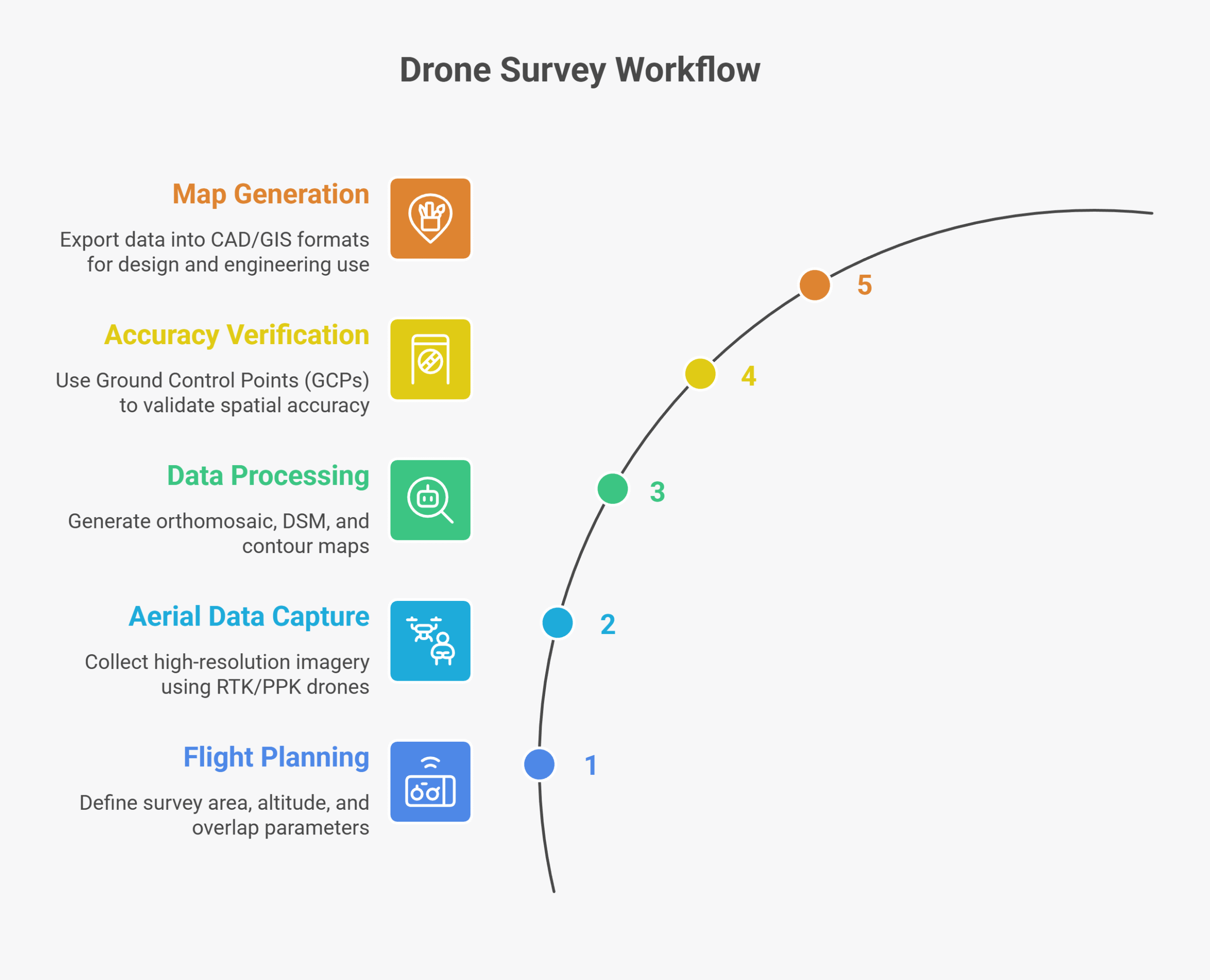
Process Flow

Reference Image

Relevant Outcomes / Deliverables
| Deliverable | Format | Usage |
|---|---|---|
| 3D Textured Model | OBJ / FBX / GLTF | Visualization & design validation |
| Point Cloud | LAS / PLY | Volume & structural analysis |
| Orthomosaic | GeoTIFF | 2D reference mapping |
| Progress Timeline | MP4 / PDF | Project tracking |
Achievable Accuracy
| Parameter | Typical Accuracy | Depends On |
|---|---|---|
| Dimensional Accuracy | ±2–5 cm | Sensor calibration, flight geometry |
| Texture Accuracy | High fidelity | Lighting and overlap quality |
Key Advantages
- Realistic visualization for planning and simulation
- Enables digital twin generation
- Simplifies design validation and client presentations
- Compatible with CAD/BIM platforms
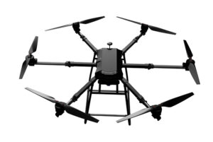
Compatible Drone Platforms
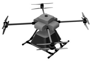
- Multirotor (Skywing90)
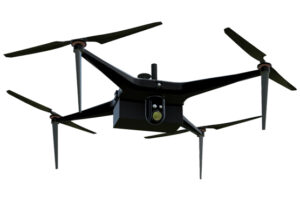
- VTOL (Sentinel)
Supported Sensors / Payloads
- RGB / Oblique Cameras
- LiDAR (optional for hybrid models)
Industry Segments Benefited
- Architecture
- Urban Planning
- Construction Management
- Infrastructure Monitoring
Volumetric Measurements
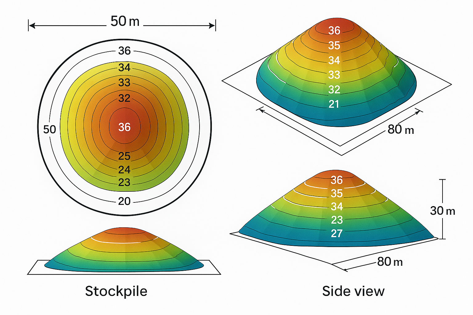
Stockpile Volume Measurement & Earthwork Estimation
Overview
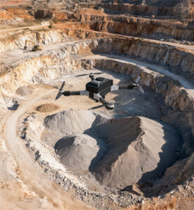
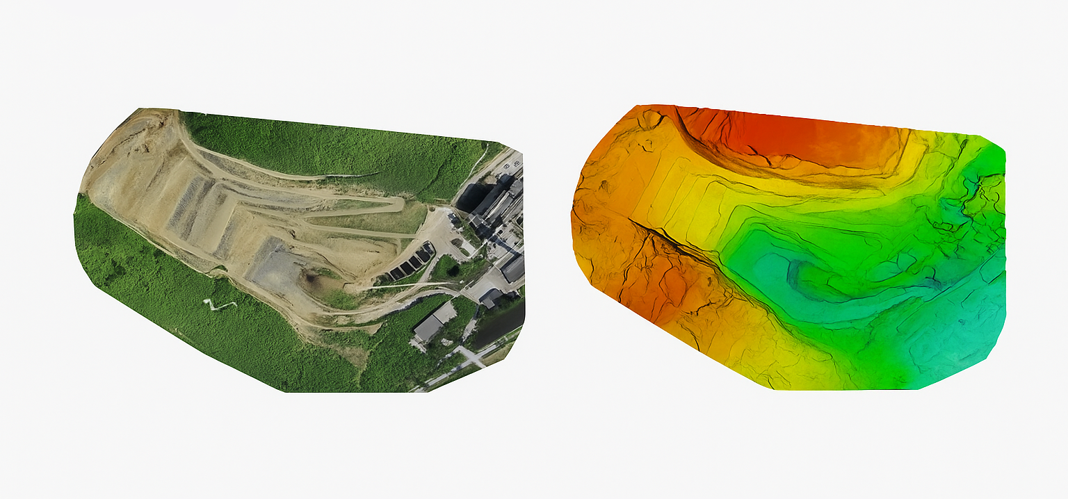
Drone-based volumetric surveys enable precise calculation of stockpile and excavation volumes in construction, quarrying, and mining sites. Using high-resolution imagery and photogrammetry, drones produce accurate 3D surface models to estimate material quantities. This method replaces manual or ground-based volume surveys with safer, faster, and highly accurate alternatives.
Process Flow

Reference Image

Relevant Outcomes / Deliverables
| Deliverable | Format | Usage |
|---|---|---|
| Volume Report | PDF / CSV | Inventory tracking |
| 3D Surface Model | OBJ / LAS | Visualization |
| Orthomosaic Map | GeoTIFF | Area reference |
| Cut/Fill Analysis | DXF / SHP | Earthwork estimation |
Achievable Accuracy
| Parameter | Typical Accuracy | Depends On |
|---|---|---|
| Volume Accuracy | ±3–5% | Surface texture, overlap |
| Horizontal Accuracy | ±3 cm | RTK/GCP integration |
Key Advantages
- Eliminates manual errors in stockpile measurement
- Safe and contactless data collection
- Accurate audit-ready reports
- Enables time-series change tracking
Compatible Drone Platforms
- Multirotor (Skywing90)
- VTOL (Sentinel)
Supported Sensors / Payloads
- RGB / Photogrammetry/LiDAR Cameras
Industry Segments Benefited
- Construction
- Quarrying
- Mining
- Logistics
- Material Management
Industry Segments Benefited
LiDAR mapping of a 50 km powerline corridor in Gujarat achieved 4 cm vertical accuracy, identifying 23 vegetation encroachments and optimizing trimming schedules.
LiDAR Scanning
LiDAR-Based Terrain & Infrastructure Mapping
Overview
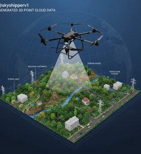
LiDAR-equipped drones deliver ultra-precise 3D mapping by emitting laser pulses that penetrate vegetation and capture millions of elevation points. The resulting point clouds generate detailed 3D models of terrain, buildings, and corridors. Ideal for highway, rail, and powerline mapping, LiDAR scanning overcomes the limitations of traditional optical imaging by accurately capturing vertical structures and dense vegetation.
Process Flow

Reference Image


Figure 1 DTM, DSM and DEM from top to bottom
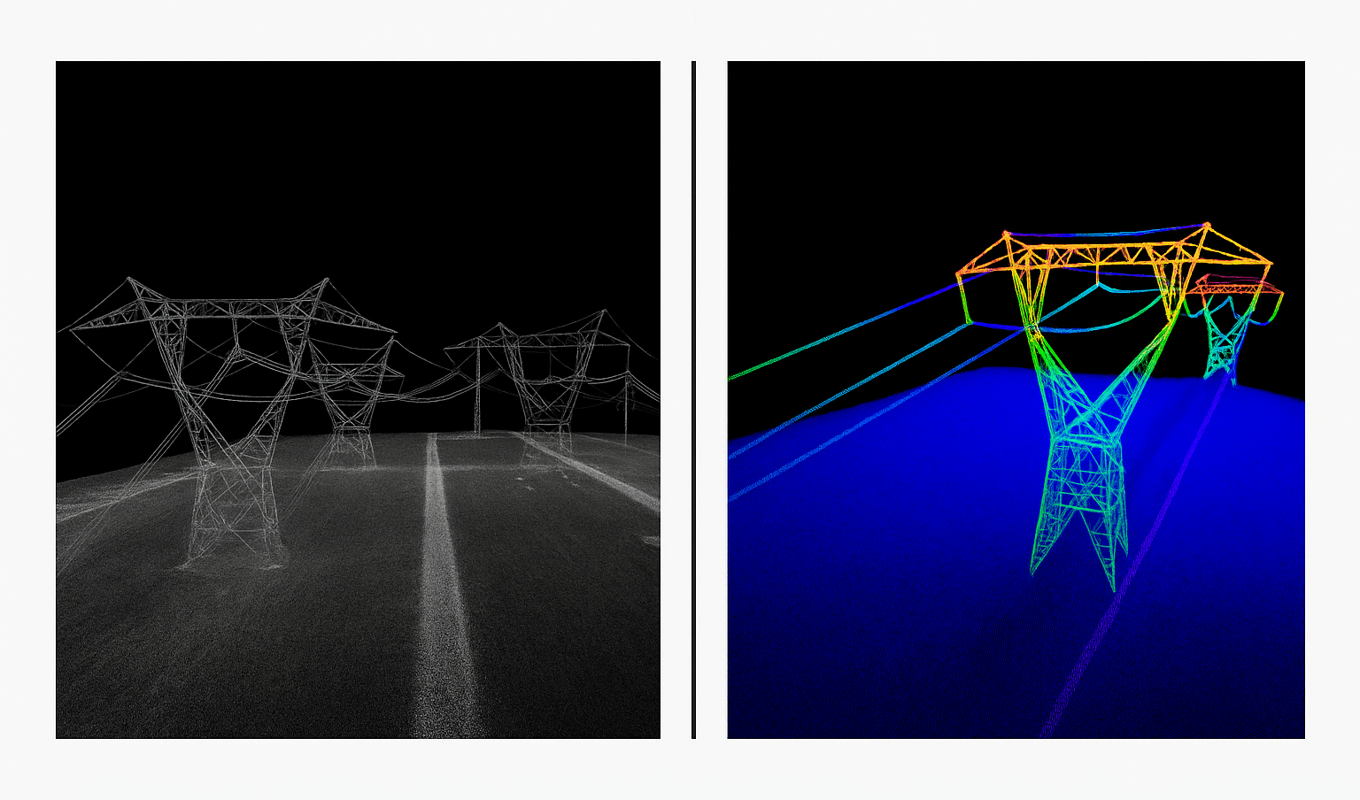
Figure 2: Colored and uncolored point cloud of powerlines
Relevant Outcomes / Deliverables
| Deliverable | Format | Usage |
|---|---|---|
| LiDAR Point Cloud | LAS / PLY | Terrain modeling |
| DEM / DTM | GeoTIFF | Infrastructure alignment |
| 3D Model | OBJ / FBX | Visualization & analysis |
| Feature Extraction | SHP / DXF | Corridor mapping, utilities |
Achievable Accuracy
| Parameter | Typical Accuracy | Depends On |
|---|---|---|
| Horizontal Accuracy | ±3 cm | GNSS precision, IMU calibration |
| Vertical Accuracy | ±5 cm | Flight height, overlap |
| Point Density | 100–500 pts/m² | LiDAR sensor capability |
Key Advantages
- High accuracy even under vegetation
- Fast corridor mapping for linear infrastructure
- Generates dense, classified 3D data
- Enables automated feature extraction
Compatible Drone Platforms
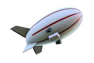
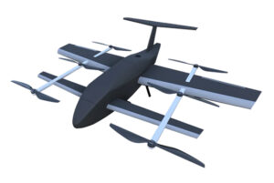
- Heavy-lift multirotor (Skywing90) or VTOL drones (Sentinel)
Supported Sensors / Payloads
- RIEGL miniVUX, Livox Avia, Hesai XT32, or Velodyne series LiDARs
- Integrated RGB for colorized point clouds
Industry Segments Benefited
- Transportation
- Powerline & Pipeline Mapping
- Mining
- Forest Survey
- Urban Planning
Industry Segments Benefited
LiDAR mapping of a 50 km powerline corridor in Gujarat achieved 4 cm vertical accuracy, identifying 23 vegetation encroachments and optimizing trimming schedules.
Topographic Surveys
Topographic Surveys using Drones
Overview
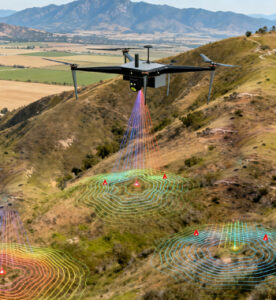
Topographic drone surveys enable rapid and accurate mapping of terrain elevation, contours, and surface features.By capturing overlapping aerial imagery and processing it through photogrammetry or LiDAR, drones generate detailed Digital Elevation Models (DEMs) and contour maps essential for construction, infrastructure planning, and land development. This method dramatically reduces field time while improving precision compared to traditional total-station or GPS surveys.
Process Flow
Reference Image
Relevant Outcomes / Deliverables
| Deliverable | Format | Usage |
|---|---|---|
| Orthomosaic Map | GeoTIFF | Base map for design |
| DSM / DTM | LAS / GeoTIFF | Elevation and slope analysis |
| Contour Map | DWG / SHP | Engineering design reference |
| Survey Report | PDF / CSV | Project documentation |
Achievable Accuracy
| Parameter | Typical Accuracy | Depends On |
|---|---|---|
| Horizontal Accuracy | ±2–3 cm | RTK/PPK setup, GCPs |
| Vertical Accuracy | ±5 cm | Terrain, sensor calibration |
Key Advantages
- 10× faster than traditional ground surveys
- Eliminates human error and site revisit cost
- Highly accurate elevation and contour data
- Compatible with CAD & GIS platforms
Compatible Drone Platforms
- Multirotor (Skywing90)
- VTOL Hybrid (Sentinel)
Supported Sensors / Payloads
- RGB Cameras (20–45 MP)
- LiDAR (optional for dense vegetation areas)
Industry Segments Benefited
- Urban Planning
- Road & Rail Projects
- Real Estate Development
- Irrigation Projects