Farm Management integrates technology, data, and operational planning to streamline and optimize agricultural activities across the entire farm lifecycle. By combining drone-based monitoring, field data analysis, and decision-support tools, farmers gain real-time visibility into crop performance, soil health, irrigation efficiency, and resource utilization.
This approach enables proactive planning, timely interventions, and accurate forecasting—helping reduce operational costs, improve yields, and ensure sustainable farming practices. Farm Management empowers farmers and agribusinesses to make informed decisions, enhance productivity, and maintain consistent farm performance season after season.
Disaster Assessment and Relief
Disaster Assessment & Relief
Overview
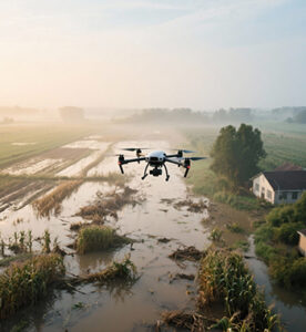
Disaster Assessment and Relief leverages drone-based remote sensing and AI analytics to evaluate the extent and severity of natural disasters such as floods, droughts, cyclones, and storms. High-resolution aerial data enables rapid and accurate mapping of affected areas, identification of damaged assets, and estimation of crop and property losses. This supports government agencies, insurance firms, and relief organizations in making evidence-based decisions, accelerating compensation processes, and optimizing the distribution of emergency aid. The approach significantly reduces assessment time, enhances transparency, and ensures timely support for impacted communities.
Process Flow


The process begins with the occurrence of a disaster such as a flood, drought, or storm, which triggers the need for rapid assessment. Drones are immediately deployed to the affected regions to quickly capture real-time data, avoiding delays associated with manual surveys. During data acquisition, the drones gather high-resolution imagery, GPS information, and multispectral data essential for detailed analysis. This collected data is then processed to detect and map damaged crops, properties, and affected zones, providing a visual understanding of the disaster’s impact. Based on these mapped insights, the extent of losses is quantified in terms of crop loss percentages, affected acreage, and estimated financial damage. The quantified results feed into automated report generation, producing GIS maps, comparison visuals, and structured damage summaries. These reports undergo validation and approval by authorities or insurance agencies to ensure accuracy and authenticity. Once verified, the findings support compensation, insurance claims, and relief distribution to affected beneficiaries. Finally, post-relief drone monitoring is carried out to track recovery progress, evaluate the effectiveness of aid, and support ongoing rehabilitation efforts.
Reference Image

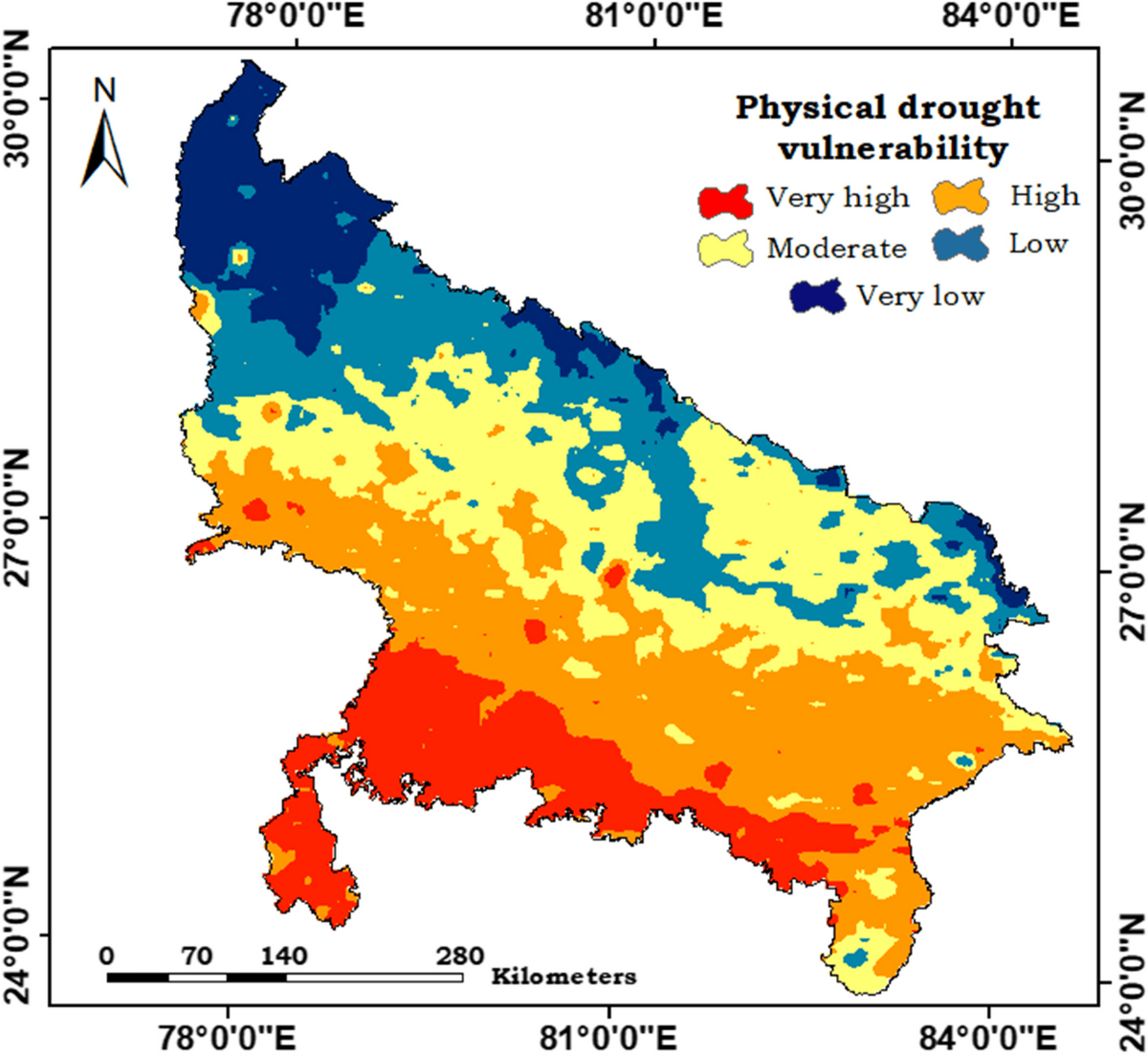
Image Source: https://link.springer.com/article/10.1007/s11356-024-33776-y
Flood Risk Mapping – LandHawk
Relevant Outcomes / Deliverables
- High-resolution disaster impact maps (flood extent, drought severity, storm damage).
- Crop damage assessment reports with quantified loss percentages.
- Property and infrastructure damage evaluation sheets.
- GIS-based zonal classification of affected, moderately affected, and severely affected areas.
- Insurance-ready documentation for crop loss and property compensation.
- Government relief distribution reports and beneficiary prioritization lists.
- Digital dashboards summarizing damage statistics and affected locations.
- Post-relief monitoring reports tracking recovery and rehabilitation progress.
Achievable Accuracy
| Assessment Type | Achievable Accuracy |
|---|---|
| Crop Damage Detection | 95% |
| Flood Extent Mapping | 98% |
| Drought Severity Assessment | 92% |
| Property Damage Identification | 95% |
| Loss Quantification | ±10% |
| Geolocation Accuracy (RTK) | 2–5 cm positional accuracy |
Key Advantages
- Rapid assessment of large disaster-affected areas within hours.
- High accuracy in detecting crop, property, and infrastructure damage.
- Reduced human risk by eliminating manual surveys in hazardous zones.
- Objective, evidence-based reports minimizing insurance and compensation disputes.
- Cost-effective alternative to traditional field inspection methods.
- Real-time insights enabling faster decision-making by authorities.
- Scalable coverage for villages and districts using automated drone missions.
- Enhanced transparency through GIS maps and digital documentation.
Compatible Drone Platforms
- Drishti
- Drishti Pro
Supported Sensors / Payloads
- RGB + Thermal camera
- GNSS module for high-precision mapping
- Cloud-based data processing and report generation
Industry Segments Benefited
- Agriculture & Agritech
- Insurance & Risk Assessment
- Government & Disaster Management Agencies
- Rural Development Departments
- Environmental & Climate Monitoring
- Infrastructure & Public Utilities
- Humanitarian & Relief Organizations (NGOs)
- Forestry & Land Management
Reference
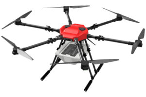
Livestock Tracking and Surveillance
Drone-Based Livestock Tracking & Surveillance
Overview
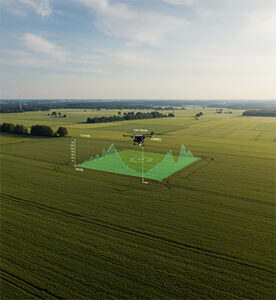
Drone-based livestock tracking and surveillance uses aerial platforms equipped with cameras, thermal sensors, and AI analytics to monitor animal movement, health, and behavior across large grazing areas. Drones provide real-time visibility of herds, enabling farmers to quickly locate animals, detect missing or injured livestock, and identify abnormal patterns such as reduced activity or stress. High-resolution and thermal imaging support herd distribution analysis, grazing behavior monitoring, and threat detection including predators or trespassers. Automated flight paths and AI-powered image analysis reduce manual labor, improve monitoring accuracy, and enable efficient herd management even in remote or rugged terrain. Overall, this approach enhances livestock safety, lowers operational costs, and supports data-driven farm management.
Process Flow

Image Source: Applications of Drone Farming in Livestock Management – SlideTeam
Reference Image
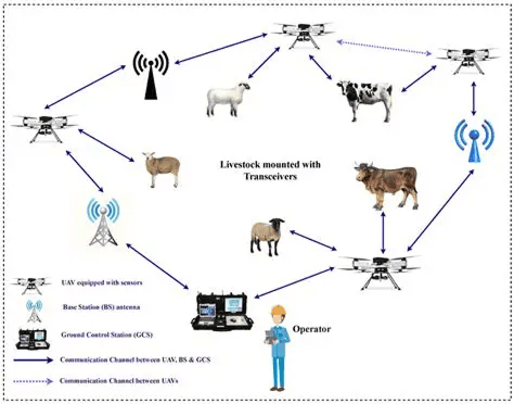

Image Source: Communications Network Architecture of UAV-Based Livestock Management – Scientific Diagram
Drone Livestock Monitoring – Benefits, Technology & Workflow
Relevant Outcomes / Deliverables
- Continuous tracking of herd movement and individual animal positions.
- Aerial maps showing grazing patterns, population density, and movement trends.
- Rapid identification and location of lost or isolated animals.
- Early warning alerts for predators, intruders, or unusual activity.
- Thermal-based detection for animal health monitoring, calving, and night operations.
- Summarized insights on herd activity, grazing efficiency, and movement history.
- Perimeter monitoring and activity logs for enhanced farm security.
- Reduced manual labor and optimized patrolling routes.
Achievable Accuracy
| Parameter | Achievable Accuracy / Error Range |
|---|---|
| Animal Identification & Localization | 95% accuracy |
| Thermal-Based Tracking (Low-Light / Night) | 95% accuracy |
| Missing / Stray Animal Detection | 90% accuracy |
| Herd Size & Density Estimation | 90% accuracy |
Key Advantages
- Enables continuous livestock monitoring across large or remote grazing areas.
- Minimizes the need for physical patrolling and ground-based tracking.
- Quick detection of predators, intruders, or abnormal farm activity.
- Provides insights into grazing patterns, pasture utilization, and herd movement.
- Thermal sensors ensure reliable surveillance in low-light and night conditions.
- Accelerates emergency response for missing, injured, or stranded animals.
- Reduces operational costs compared to vehicle-based or manual monitoring.
- Delivers actionable analytics for herd planning and health management.
- Performs effectively in rugged, forested, and hard-to-access terrain.
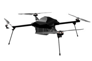
Compatible Drone Platforms
- Drishti
- Drishti Pro
Supported Sensors / Payloads
- Thermal + RGB camera
- GPS tracker integration
- Live-streaming module
Industry Segments Benefited
- Livestock Farming & Ranching
- Dairy Farms
- Sheep & Goat Farming Units
- Poultry & Free-Range Farming
- Agri-Tech & Farm Management Companies
- Wildlife & Forest Departments
- Veterinary & Animal Health Services
- Farm Security & Surveillance Providers
- Research & Academic Institutions
Reference
Yield Estimation and Mapping
Yield Estimation and Mapping
Overview
Field estimation and mapping involves using drones and geospatial analytics to accurately measure, visualize, and analyze farmland characteristics. High-resolution aerial imagery is processed to determine field boundaries, area coverage, crop distribution, plant density, and overall field variability. This enables farmers to understand the exact size, condition, and productivity potential of their land. By converting raw images into actionable maps, the process supports better planning, resource allocation, and yield forecasting, making farm management more precise, efficient, and data-driven.
Process Flow
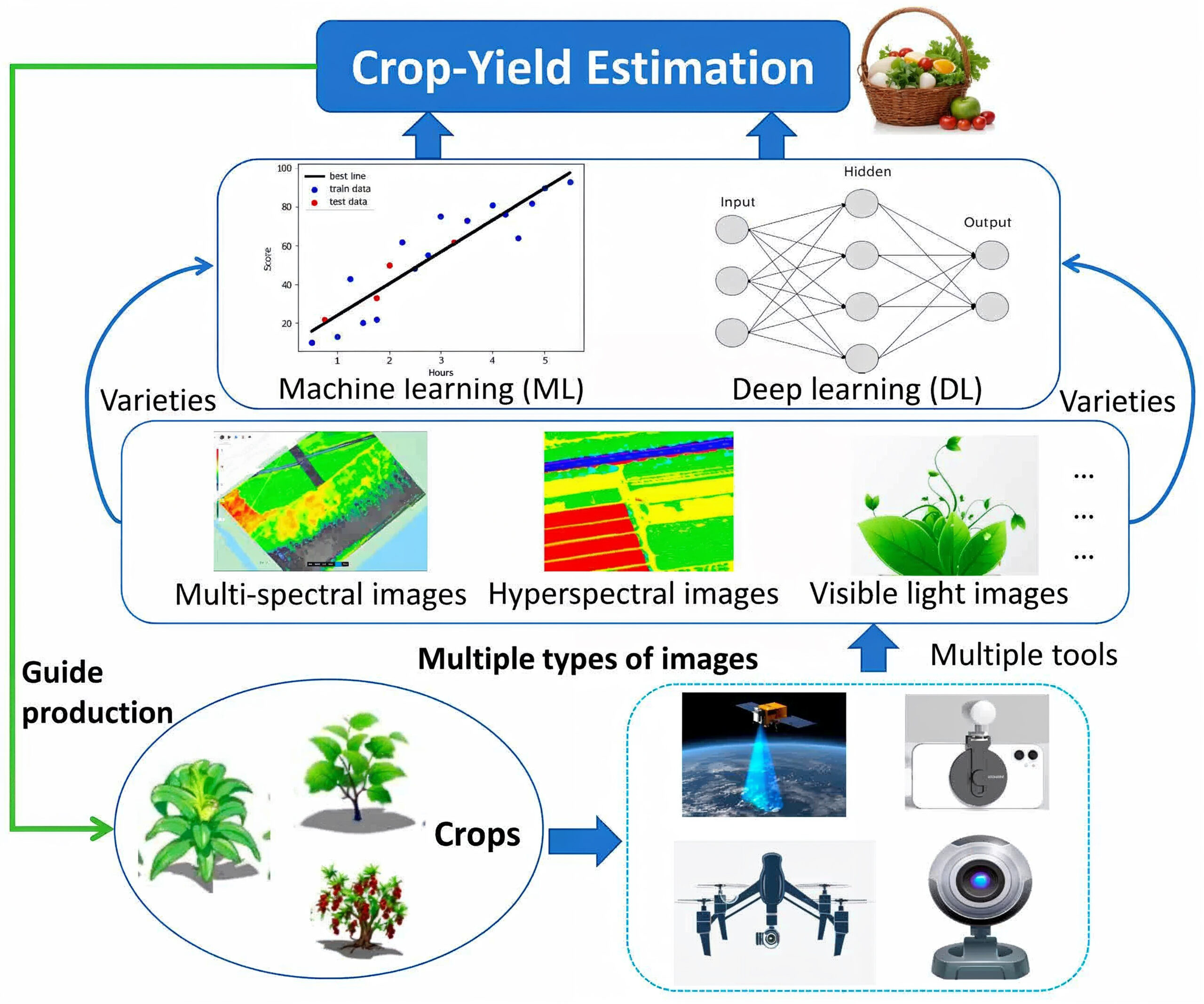
Image Source : Advancements in Utilizing Image-Analysis Technology for Crop-Yield Estimation
The workflow for crop-yield estimation begins with collecting field data using drones and sensing devices. These tools capture multispectral, hyperspectral, and RGB imagery that reveal plant health, nutrient status, canopy growth, and stress conditions. The collected imagery is processed through advanced AI systems. Machine Learning models analyze image features and historical yield patterns to establish baseline predictions, while Deep Learning models automatically learn complex relationships within the data for higher prediction accuracy. Crop variety information is integrated to ensure variety-specific yield estimation. The final output delivers reliable crop-yield predictions that support irrigation planning, fertilizer optimization, harvest scheduling, and overall production strategy.
Reference Image


Image Source:
Advancements in Utilizing Image-Analysis Technology for Crop-Yield Estimation
Yield Mapping Technology – Yield maps in Precision Agriculture (Aspexit)
Relevant Outcomes / Deliverables
- Provides reliable crop yield estimates at field, zone, and plot levels.
- Delivers high-resolution maps showing yield variability across the entire farm.
- Identifies low-yield zones caused by nutrient deficiency, disease, pests, or water stress.
- Optimizes fertilizer, irrigation, and pesticide application using spatial yield patterns.
- Offers time-series insights on crop development throughout the season.
- Predicts yield quantities for efficient labor, machinery, and logistics planning.
- Supports profit forecasting, cost planning, and market decision-making.
- Evaluates crop variety performance under different field conditions.
- Enables multi-year benchmarking to assess productivity improvement or decline.
Achievable Accuracy
| Parameter | Achievable Accuracy / Error Range |
|---|---|
| Overall Yield Prediction Accuracy | 95% |
| Zone-Level Yield Variation Detection | 90% accuracy |
| Field-Level Yield Forecast Error | 10% error margin |
| Stress & Low-Yield Region Identification | 90% accuracy |
| Season-to-Season Accuracy Consistency | ±5% |
Key Advantages
- Provides accurate, science-based yield predictions for informed planning.
- Identifies crop stress caused by pests, disease, or nutrient imbalance.
- Supports precise fertilizer, irrigation, and pesticide application.
- Enables smarter harvesting, storage, and market planning decisions.
- Minimizes wastage through targeted, zone-specific interventions.
- Improves overall yield by enabling early and accurate corrective action.
- Supports variable-rate application and precision field management.
- Provides year-on-year insights to evaluate farm performance.
- Helps forecast yield losses and supports timely mitigation strategies.
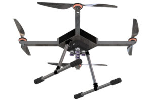
Compatible Drone Platforms
- Drishti
- Drishti Pro
Supported Sensors / Payloads
- Multispectral or RGB camera
- Data analytics and AI models for yield prediction
Industry Segments Benefited
- Agriculture & Farming
- Agri-Tech Companies
- Seed & Crop Input Companies
- Food Processing & FMCG
- Government & Agriculture Departments
- Agri-Lenders
- Research & Academic Institutions
- Agri-Retail & Fertilizer Companies